IMAGES TAKEN NEAR TO
Bursar Way, NOTTINGHAM, NG10 4AT
Introduction
This page details the photographs taken nearby to Bursar Way, NG10 4AT by members of the Geograph project.
The Geograph project started in 2005 with the aim of publishing, organising and preserving representative images for every square kilometre of Great Britain, Ireland and the Isle of Man.

There are currently over 7.5m images from over14,400 individuals and you can help contribute to the project by visiting https://www.geograph.org.uk
Image Map
Images are licensed for reuse under creativecommons.org/licenses/by-sa/2.0
Notes
- Clicking on the map will re-center to the selected point.
- The higher the marker number, the further away the image location is from the centre of the postcode.
Image Listing (70 Images Found)
Images are licensed for reuse under creativecommons.org/licenses/by-sa/2.0
Image
Details
Distance
1
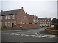
Bursar Way, Long Eaton
A relatively new residential cul de sac off College Street.
Image: © Richard Vince
Taken: 25 Sep 2013
0.04 miles
3
College Street, Long Eaton (1)
At its junction with Welbeck Road (right) near the north end of Long Eaton.
Image: © Richard Vince
Taken: 25 Sep 2013
0.11 miles
4
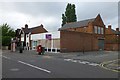
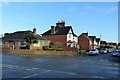
Empty Shop on College Street
On the corner of Dockholm Road. Last occupied by a Sainsbury's Local which closed last year,
Image: © David Lally
Taken: 7 Jul 2016
0.12 miles
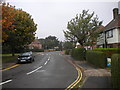
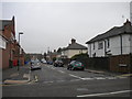
5
Suburban Long Eaton
The crossing of Breedon Street and Ravensdale Avenue.
Image: © Alan Murray-Rust
Taken: 7 Jan 2018
0.12 miles
6
Dockholm Road, Long Eaton
A residential street linking College Street (foreground) with Wellington Street.
Image: © Richard Vince
Taken: 25 Sep 2013
0.13 miles
7
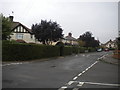
North end of Breedon Street, Long Eaton
Home to some impressively manicured hedgerows. Seen from Ravensdale Avenue.
Image: © Richard Vince
Taken: 25 Sep 2013
0.13 miles
8
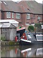
A garden full of boats, the Erewash Canal, Long Eaton
Perch is on land, hiding behind the shed, and Tasmania is in the water.
Image: © Christine Johnstone
Taken: 24 Jan 2010
0.13 miles
9
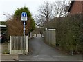
Pathway to Dockholme Lock
The Erewash Canal towpath forms part of Sustrans route 67, as indicated by the signs, as well as the Erewash Valley Way and the Nutbrook Trail long distance paths.
Image: © Alan Murray-Rust
Taken: 1 Jan 2018
0.14 miles
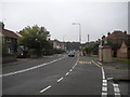
10
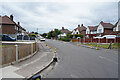
Welback Road
The road has a number of no parking cones around the junction. Perhaps due to people not parking considerately at the school / nursery a little way to the left of the camera position.
Image: © Malcolm Neal
Taken: 24 Jun 2021
0.14 miles