
IMAGES TAKEN NEAR TO
Draycott Road, NOTTINGHAM, NG10 3BY
Introduction
This page details the photographs taken nearby to Draycott Road, NG10 3BY by members of the Geograph project.
The Geograph project started in 2005 with the aim of publishing, organising and preserving representative images for every square kilometre of Great Britain, Ireland and the Isle of Man.

There are currently over 7.5m images from over14,400 individuals and you can help contribute to the project by visiting https://www.geograph.org.uk
Image Map
Images are licensed for reuse under creativecommons.org/licenses/by-sa/2.0
Notes
- Clicking on the map will re-center to the selected point.
- The higher the marker number, the further away the image location is from the centre of the postcode.
Image Listing (17 Images Found)
Images are licensed for reuse under creativecommons.org/licenses/by-sa/2.0
Image
Details
Distance
1
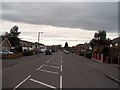
Draycott Road in Sawley
Looking towards the M1 Motorway on a mild Sunday in mid April.
Image: © Jonathan Clitheroe
Taken: 14 Apr 2013
0.02 miles
3
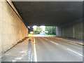
Draycott Road under the M1
With a westering sun shining though the underpass.
Image: © David Lally
Taken: 3 Aug 2017
0.11 miles
4
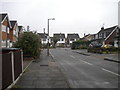
North end of Weston Crescent, Old Sawley
Image: © Richard Vince
Taken: 25 Sep 2013
0.12 miles
5
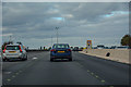
Erewash : M1 Motorway
The M1 Motorway between Junction 24A and Junction 25 (Sandiacre).
Image: © Lewis Clarke
Taken: 30 Sep 2018
0.14 miles
6
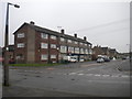
Shops and flats on Wilmot Street, Old Sawley
Image: © Richard Vince
Taken: 25 Sep 2013
0.15 miles
8
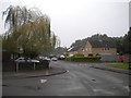
Peveril Crescent, Old Sawley
Seen from the junction with Osmaston Close (left).
Image: © Richard Vince
Taken: 25 Sep 2013
0.17 miles
9
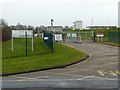
Severn Trent Church Wilne
Entrance to the water treatment works off Draycott Road.
Image: © Alan Murray-Rust
Taken: 1 Jan 2018
0.17 miles
10
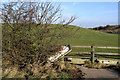
Redundant bath?
The horses kept in this field are supplied with water from two "Avocado Green" baths. Did they replace the white one, or are they to be replaced?
The field itself consists largely of a man-made embankment - there for no apparent reason. The brown embankment on the far right carries the M1 motorway.
Image: © David Lally
Taken: 29 Dec 2007
0.19 miles