
IMAGES TAKEN NEAR TO
Charles Street, NOTTINGHAM, NG10 1DJ
Introduction
This page details the photographs taken nearby to Charles Street, NG10 1DJ by members of the Geograph project.
The Geograph project started in 2005 with the aim of publishing, organising and preserving representative images for every square kilometre of Great Britain, Ireland and the Isle of Man.

There are currently over 7.5m images from over14,400 individuals and you can help contribute to the project by visiting https://www.geograph.org.uk
Image Map
Images are licensed for reuse under creativecommons.org/licenses/by-sa/2.0
Notes
- Clicking on the map will re-center to the selected point.
- The higher the marker number, the further away the image location is from the centre of the postcode.
Image Listing (91 Images Found)
Images are licensed for reuse under creativecommons.org/licenses/by-sa/2.0
Image
Details
Distance
1
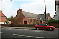
St Francis of Assisi RC Church
On Tamworth Road.
Image: © David Lally
Taken: 30 Aug 2008
0.05 miles
2
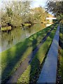
Erewash Canal alongside Tamworth Road
There is a bench mark http://www.geograph.org.uk/photo/5643506 on the upper surface of the low wall bottom right.
Image: © Alan Murray-Rust
Taken: 1 Jan 2018
0.06 miles
3
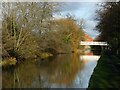
Erewash Canal alongside Tamworth Road
The footbridge gives (private) access to Long Eaton School.
Image: © Alan Murray-Rust
Taken: 1 Jan 2018
0.06 miles
4
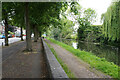
The canal by Tamworth Road
The canal is part of the Erewash canal and runs down to Trent Lock.
Image: © Malcolm Neal
Taken: 17 Jun 2021
0.06 miles
5
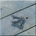
Bench mark alongside the canal, Long Eaton
See http://www.geograph.org.uk/photo/5643507 for location.
Image: © Alan Murray-Rust
Taken: 1 Jan 2018
0.06 miles
6
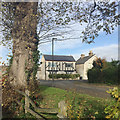
Junction of Fairlea Close and Manchester Street, Long Eaton
The view is from a footpath out of Collingwood Road Recreation Ground Image The modest houses are dwarfed by a magnificent Wych Elm (Ulmus glabra).
Image: © Robin Stott
Taken: 18 Nov 2017
0.06 miles
7
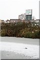
Sign for the Long Eaton School Nature Corridor
The nature corridor is a small piece of wetland created in the south west corner of the school playing fields next to the Erewash Canal. The project was co-ordinated by a small group of environment pupils in their 'A' level years. One of its aims is to encourage the water vole.
The sign is seen from the other side of the canal, from the towpath.
Image: © David Lally
Taken: 10 Jan 2010
0.07 miles
8
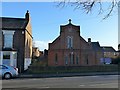
Church of St Francis of Assisi, Tamworth Road
Roman Catholic parish church, dating from around 1900.
There is a bench mark http://www.geograph.org.uk/photo/5643510 on the house at the left hand side of the picture.
Image: © Alan Murray-Rust
Taken: 1 Jan 2018
0.07 miles
9
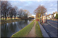
Erewash Canal, Long Eaton
Looking along the straight stretch of the canal than runs parallel with Tamworth Road.
Image: © Stephen McKay
Taken: 1 Jan 2010
0.08 miles
10
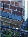
Bench mark, 197 Tamworth Road, Long Eaton
See http://www.geograph.org.uk/photo/5643513 for location.
Image: © Alan Murray-Rust
Taken: 1 Jan 2018
0.08 miles