IMAGES TAKEN NEAR TO
St. Johns Street, NOTTINGHAM, NG10 1BW
Introduction
This page details the photographs taken nearby to St. Johns Street, NG10 1BW by members of the Geograph project.
The Geograph project started in 2005 with the aim of publishing, organising and preserving representative images for every square kilometre of Great Britain, Ireland and the Isle of Man.

There are currently over 7.5m images from over14,400 individuals and you can help contribute to the project by visiting https://www.geograph.org.uk
Image Map
Images are licensed for reuse under creativecommons.org/licenses/by-sa/2.0
Notes
- Clicking on the map will re-center to the selected point.
- The higher the marker number, the further away the image location is from the centre of the postcode.
Image Listing (220 Images Found)
Images are licensed for reuse under creativecommons.org/licenses/by-sa/2.0
Image
Details
Distance
1
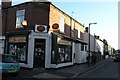
Cobden Street PO
On the published list for closure of 2 Oct 07
Image: © David Lally
Taken: 5 Oct 2007
0.01 miles
3
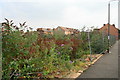
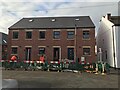
Forest of Buddleja
This patch of wasteland is bordered by Tamworth Road, St Johns Street and Clumber Street (from where this was taken)
The Brooklands Junior School which stood here was closed some years ago, then very suddenly it was demolished in 2005 - to much local protests. The owners of the site had intentions of building apartments on the site but had no planning permission to do so and since then the ground has lain waste.
They probably got a tidy sum for the bricks though!
Plans were submitted in July 2008 to build 18 new properties on the site.
Image: © David Lally
Taken: 30 Aug 2008
0.03 miles
4
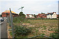
Site of Old School
This patch of wasteland is bordered by Tamworth Road, St Johns Street and Clumber Street (from where this was taken)
The Brooklands Junior School which stood here was closed some years ago, then very suddenly it was demolished in 2005 - to much local protests. The owners of the site had intentions of building apartments on the site but had no planning permission to do so and since then the ground has lain waste.
They probably got a tidy sum for the bricks though!
Plans were submitted in July 2008 to build 18 new properties on the site.
Image: © David Lally
Taken: 30 Aug 2008
0.03 miles
6
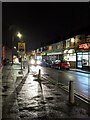
Approach to Railway crossing
Approach to Railway crossing, Long Eaton
Image: © Ed6767
Taken: 14 Feb 2021
0.04 miles
7

Long Eaton Off-shots
Typical late-Victorian houses with an off-shot to the rear, these days no doubt housing a kitchen on the ground floor with a bathroom above.
These houses face on to Tamworth Road.
Image: © David Lally
Taken: 30 Aug 2008
0.04 miles
8

Co-op on Clumber Street
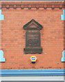
The plaque reads Long Eaton Working Men's Cooperative Society.
Image: © David Lally
Taken: 30 Aug 2008
0.04 miles