IMAGES TAKEN NEAR TO
Burnhope Gardens, GATESHEAD, NE9 7LU
Introduction
This page details the photographs taken nearby to Burnhope Gardens, NE9 7LU by members of the Geograph project.
The Geograph project started in 2005 with the aim of publishing, organising and preserving representative images for every square kilometre of Great Britain, Ireland and the Isle of Man.

There are currently over 7.5m images from over14,400 individuals and you can help contribute to the project by visiting https://www.geograph.org.uk
Image Map
Images are licensed for reuse under creativecommons.org/licenses/by-sa/2.0
Notes
- Clicking on the map will re-center to the selected point.
- The higher the marker number, the further away the image location is from the centre of the postcode.
Image Listing (25 Images Found)
Images are licensed for reuse under creativecommons.org/licenses/by-sa/2.0
Image
Details
Distance
1
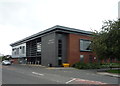
Wrekenton Health Centre
On Springwell Road.
Image: © JThomas
Taken: 18 Aug 2018
0.11 miles
2
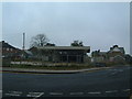
Wrekenton petrol station
A disused petrol station just off the High Street. To the left the road goes down to Eighton Banks. To the right, the road goes down to Birtley.
Image: © Steve McShane
Taken: 29 Oct 2005
0.12 miles
3
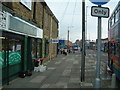
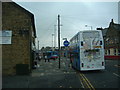
Central Wrekenton
The high street area, mainly accessible only to pedestrians, cycles, buses and taxis.
Image: © Steve McShane
Taken: 29 Oct 2005
0.12 miles
6
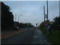
Springwell Road
It's a road - the B1296 - and that's about all. This is the view looking towards Wrekenton.
Image: © Steve McShane
Taken: 29 Oct 2005
0.13 miles
7
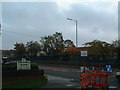
Springwell Estate
Fell Dyke Community Primary School - just like the sign says! In the foreground, a sign that has seen better days lets drivers with sharp eyesight know that they are welcome, but only if they drive carefully... so not many then, judging by some of the traffic I've seen there...
Image: © Steve McShane
Taken: 29 Oct 2005
0.16 miles
8
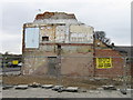
Demolition of 91 High Street, Wrekenton
Image: © Alex McGregor
Taken: 19 Apr 2010
0.17 miles
9
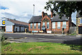
Wrekenton School, now Wrekenton Hub
The old Wrekenton School building is dated 1899 on the central stonework where the letters GSB also appear - presumably Gateshead School Board. It's now the premises of Wrekenton Hub which are occupied by The Gateshead Housing Company, Wrekenton Community Base and Wrekenton Library.
Image: © Trevor Littlewood
Taken: 20 Jul 2019
0.18 miles