IMAGES TAKEN NEAR TO
Sacriston Gardens, GATESHEAD, NE9 7ES
Introduction
This page details the photographs taken nearby to Sacriston Gardens, NE9 7ES by members of the Geograph project.
The Geograph project started in 2005 with the aim of publishing, organising and preserving representative images for every square kilometre of Great Britain, Ireland and the Isle of Man.

There are currently over 7.5m images from over14,400 individuals and you can help contribute to the project by visiting https://www.geograph.org.uk
Image Map
Images are licensed for reuse under creativecommons.org/licenses/by-sa/2.0
Notes
- Clicking on the map will re-center to the selected point.
- The higher the marker number, the further away the image location is from the centre of the postcode.
Image Listing (26 Images Found)
Images are licensed for reuse under creativecommons.org/licenses/by-sa/2.0
Image
Details
Distance
1
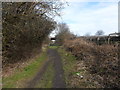
Team Waggonway at Wrekenton
This path follows the track bed of the colliery line that ran from the coal mines at Ravensworth Park (Team Valley) to the coal staithes at Pelaw Main on the Tyne. Due to the terrain between these two points rope haulage and self acting inclines had to be used.
In later years the line formed part of the Bowes Railway system and was connected to it at Wrekenton when the Whitehills incline down to the Tyne was closed.
Image: © Anthony Foster
Taken: 25 Feb 2015
0.09 miles
2
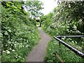
Former mineral railway
The line from Team Valley Colliery ran past Wrekenton here. Now the trackbed is a path.
Image: © Richard Webb
Taken: 18 Jun 2013
0.10 miles
3
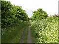
Former mineral railway
It served the Team Colliery.
Image: © Richard Webb
Taken: 18 Jun 2013
0.10 miles
4
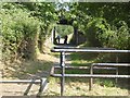
Access control on the Angel Cycleway
Beyond, the cycleway which follows the line of an old railway passes under Easedale Gardens. Golfers have to follow a short length of the cycleway to reach the northern end of Ravensworth Golf Club.
Image: © Oliver Dixon
Taken: 26 Jul 2018
0.10 miles
5
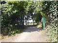
Gate into the northern end of Ravensworth Golf Club
Off the Angel Cycleway.
Image: © Oliver Dixon
Taken: 26 Jul 2018
0.10 miles
7
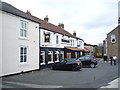
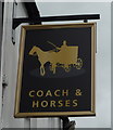
The Coach & Horses, Wrekenton
On High Street.
Image: © JThomas
Taken: 18 Aug 2018
0.12 miles