
IMAGES TAKEN NEAR TO
Heatherlaw, GATESHEAD, NE9 6RY
Introduction
This page details the photographs taken nearby to Heatherlaw, NE9 6RY by members of the Geograph project.
The Geograph project started in 2005 with the aim of publishing, organising and preserving representative images for every square kilometre of Great Britain, Ireland and the Isle of Man.

There are currently over 7.5m images from over14,400 individuals and you can help contribute to the project by visiting https://www.geograph.org.uk
Image Map
Images are licensed for reuse under creativecommons.org/licenses/by-sa/2.0
Notes
- Clicking on the map will re-center to the selected point.
- The higher the marker number, the further away the image location is from the centre of the postcode.
Image Listing (14 Images Found)
Images are licensed for reuse under creativecommons.org/licenses/by-sa/2.0
Image
Details
Distance
3
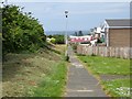
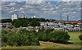
Path, Beacon Lough
Between two housing estates on Gateshead Fell.
Image: © Richard Webb
Taken: 18 Jun 2013
0.17 miles
5
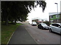
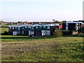
High Fell
View of flats at Beacon Lough on High Fell in Gateshaed.
Image: © Peter McDermott
Taken: 12 Jun 2011
0.21 miles
7
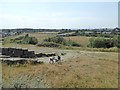
View to the north-west from the "Fortress"
Whitehill Drive can be seen in the middle distance.
Image: © Oliver Dixon
Taken: 26 Jul 2018
0.23 miles
8
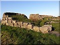
'The Fortress', Whitehills
A sculpture in stone blocks and earth 30m long and 15m wide by Richard Cole 1986. The granite blocks came from the old Scotswood Bridge. Resembles a fortification on the top of the hill, a former colliery pit heap. Known locally as 'the fortress'.
http://www.twsitelines.info/Siteline.nsf/8f71f680ce308c9a802573a80061c133/d64175f0c7141e50802576af003eb20a
Image: © Andrew Curtis
Taken: 20 May 2012
0.24 miles
9
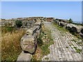
"The Fortress" on White Hill
Locally known as the "Fortress", a structure on top of White Hill - for further details see Image At 261 metres, White Hill is believed to be the highest point within Gateshead Borough (and within the former county of Tyne and Wear).
Image: © Oliver Dixon
Taken: 26 Jul 2018
0.24 miles
10
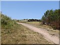
"The Fortress" on White Hill
Locally known as the "Fortress", a structure on top of White Hill - for further details see Image At 261 metres, White Hill is believed to be the highest point within Gateshead Borough (and within the former county of Tyne and Wear).
Image: © Oliver Dixon
Taken: 26 Jul 2018
0.24 miles