
IMAGES TAKEN NEAR TO
Southend Terrace, GATESHEAD, NE9 6QL
Introduction
This page details the photographs taken nearby to Southend Terrace, NE9 6QL by members of the Geograph project.
The Geograph project started in 2005 with the aim of publishing, organising and preserving representative images for every square kilometre of Great Britain, Ireland and the Isle of Man.

There are currently over 7.5m images from over14,400 individuals and you can help contribute to the project by visiting https://www.geograph.org.uk
Image Map
Images are licensed for reuse under creativecommons.org/licenses/by-sa/2.0
Notes
- Clicking on the map will re-center to the selected point.
- The higher the marker number, the further away the image location is from the centre of the postcode.
Image Listing (34 Images Found)
Images are licensed for reuse under creativecommons.org/licenses/by-sa/2.0
Image
Details
Distance
1
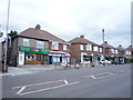
Shops on Old Durham Road, Sherrif Hill, Gateshead
Image: © JThomas
Taken: 18 Aug 2018
0.02 miles
2
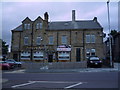
The Travellers Rest public house
On Old Durham Road (B1296).
Image: © JThomas
Taken: 18 Aug 2018
0.04 miles
3
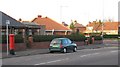
Houses at the junction of Southend Road and Old Durham Road
Shows the location of Image
Image: © Mike Quinn
Taken: 3 Nov 2009
0.05 miles
4
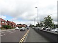
View along Queen Elizabeth Avenue
Looking north along this suburban street in the Sheriff Hill area of Gateshead. This estate must be post war, as it takes its name from the hospital which opened in 1948. The hospital car park is on the right.
Image: © Robert Graham
Taken: 5 Jul 2019
0.05 miles
5
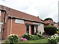
A nice garden
On Queen Elizabeth Avenue, Sheriff Hill, Gateshead. Obviously keen gardeners live here. This is a post war suburb on the south side of the town, beside the hospital of the same name.
Image: © Robert Graham
Taken: 5 Jul 2019
0.06 miles
6
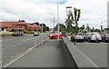
Looking north along Queen Elizabeth Avenue, Sheriff Hill
This road runs beside the hospital of the same name. The car park is on the right of the picture. The suburbs here were built after the last war, after the hospital was opened in 1948.
Image: © Robert Graham
Taken: 5 Jul 2019
0.06 miles
7
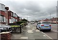
Looking south along Old Durham Road
In Sheriff Hill, a southern suburb of Gateshead. This is just north of the junction with Queen Elizabeth Avenue.
Image: © Robert Graham
Taken: 5 Jul 2019
0.07 miles
8
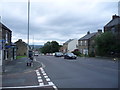
Old Durham Road, Sherrif Hill, Gateshead
Looking north west on the B1296.
Image: © JThomas
Taken: 18 Aug 2018
0.07 miles
9
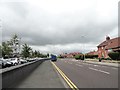
Looking south along Queen Elizabeth Avenue
This street is in the Sheriff Hill suburb of southern Gateshead. It takes its name from the Queen Elizabeth Hospital, on the left hand side here. The view is looking towards the junction up ahead with Old Durham Road.
Image: © Robert Graham
Taken: 5 Jul 2019
0.08 miles
10
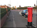
The junction of Southend Road and Old Durham Road
Shows the location of Image
Image: © Mike Quinn
Taken: 3 Nov 2009
0.09 miles