IMAGES TAKEN NEAR TO
Whitehall Road, GATESHEAD, NE8 4ER
Introduction
This page details the photographs taken nearby to Whitehall Road, NE8 4ER by members of the Geograph project.
The Geograph project started in 2005 with the aim of publishing, organising and preserving representative images for every square kilometre of Great Britain, Ireland and the Isle of Man.

There are currently over 7.5m images from over14,400 individuals and you can help contribute to the project by visiting https://www.geograph.org.uk
Image Map
Images are licensed for reuse under creativecommons.org/licenses/by-sa/2.0
Notes
- Clicking on the map will re-center to the selected point.
- The higher the marker number, the further away the image location is from the centre of the postcode.
Image Listing (78 Images Found)
Images are licensed for reuse under creativecommons.org/licenses/by-sa/2.0
Image
Details
Distance
2
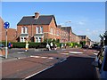
Mini-roundabout: Alexandra and Whitehall Roads
Image: © Roger Smith
Taken: 2 Jun 2009
0.06 miles
3
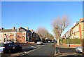
Looking down Prince Consort Road
View north past the junction with St Alban's Terrace, on the south side of the town centre. Residential housing is just off the town centre here.
Image: © Robert Graham
Taken: 18 Nov 2019
0.08 miles
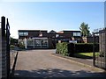
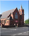
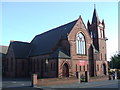
9
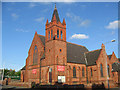
Methodist Church, Whitehall Road, Gateshead
Great brick work.
Image: © wfmillar
Taken: 12 Jun 2008
0.11 miles
