IMAGES TAKEN NEAR TO
WOOLER, NE71 6HJ
Introduction
This page details the photographs taken nearby to NE71 6HJ by members of the Geograph project.
The Geograph project started in 2005 with the aim of publishing, organising and preserving representative images for every square kilometre of Great Britain, Ireland and the Isle of Man.

There are currently over 7.5m images from over14,400 individuals and you can help contribute to the project by visiting https://www.geograph.org.uk
Image Map
Images are licensed for reuse under creativecommons.org/licenses/by-sa/2.0
Notes
- Clicking on the map will re-center to the selected point.
- The higher the marker number, the further away the image location is from the centre of the postcode.
Image Listing (14 Images Found)
Images are licensed for reuse under creativecommons.org/licenses/by-sa/2.0
Image
Details
Distance
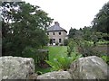
2
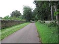
Stone wall surrounding Thirlings
Near the River Till.
Image: © Russel Wills
Taken: 25 Aug 2015
0.06 miles
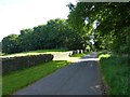
3
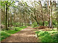
Track heading towards the River Till
At Thirlings.
Image: © Russel Wills
Taken: 25 Aug 2015
0.07 miles
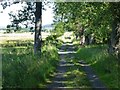
4
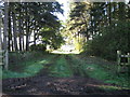
Grass path to Thirlings
Cropmarks of six rectangular buildings were discovered by aerial photography at Thirlings. Excavations between 1973 and 1981 found they were built of timber and were similar to others found in the area that dated to the sixth or seventh centuries. Finds including an Anglo-Saxon knife and pottery suggest that this was a small Anglo-Saxon settlement although Neolithic pottery was also found.
Image: © Lisa Jarvis
Taken: 22 Apr 2007
0.09 miles
5
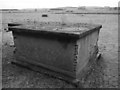
RAF Milfield - Sewage Ejector
On the opposite side of the road from the WAAF Site No 2, the ejector was part of the airfield's sewerage system and was used to force sewage to the sewage works when gravity systems could not be used because of the topography of the land.
Image: © James T M Towill
Taken: 27 Dec 2012
0.10 miles
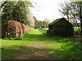
9
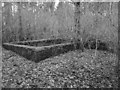
RAF Milfield - WAAF Communal Site - Blast Shelter
A blast shelter being reclaimed by nature at the former WAAF Communal Site, located in House Plantation.
Image: © James T M Towill
Taken: 27 Dec 2012
0.16 miles
10
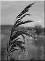
Phragmites reed, Thirlings
Phragmites reeds line the ditches at this location.
Image: © James T M Towill
Taken: 10 Nov 2019
0.17 miles