IMAGES TAKEN NEAR TO
Dunmoor Road, BELFORD, NE70 7PT
Introduction
This page details the photographs taken nearby to Dunmoor Road, NE70 7PT by members of the Geograph project.
The Geograph project started in 2005 with the aim of publishing, organising and preserving representative images for every square kilometre of Great Britain, Ireland and the Isle of Man.

There are currently over 7.5m images from over14,400 individuals and you can help contribute to the project by visiting https://www.geograph.org.uk
Image Map (Loading...)


Getting Data...Please wait
Leaflet Map data © OpenStreetMap
Images are licensed for reuse under creativecommons.org/licenses/by-sa/2.0
Notes
- Clicking on the map will re-center to the selected point.
- The higher the marker number, the further away the image location is from the centre of the postcode.
Image Listing (43 Images Found)
Images are licensed for reuse under creativecommons.org/licenses/by-sa/2.0
Image
Details
Distance
1
Houses under construction, Belford
A new housing development is under construction on the fringe of Belford. The site is adjacent to an already completed modern residential development.
Image: © Graham Robson
Taken: 4 Feb 2014
0.09 miles
2
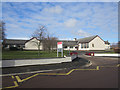
St Mary's Church of England Middle School, Belford
St Mary's Church of England Middle School is attended by pupils from the village and surrounding area. It was formerly called (in the days I attended) Belford County Middle School, but now has an association with St Mary's Church in the village, from which it now takes its name.
Image: © Graham Robson
Taken: 2 Apr 2013
0.10 miles
3
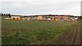
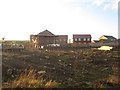
Expanding Belford
Looking across an oilseed rape crop toward a building site on the edge of Belford. 12 months ago Image shows that the house with the 2 white garage doors was still under construction and where the 4 (or 2 pairs of semi-detached) houses to the right now are was just a patch of mud.
Image: © Graham Robson
Taken: 7 Feb 2015
0.11 miles
4
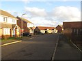
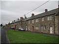
Modern housing estate, Belford
A modern housing development in Belford.
Image: © Graham Robson
Taken: 4 Feb 2014
0.11 miles
5
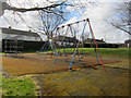
Playground off Williams Way, Belford
This playground sits on an area of grass between the back gardens of houses fronting on the 4 adjacent residential streets.
Image: © Graham Robson
Taken: 2 Apr 2013
0.14 miles
7
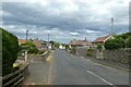
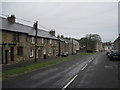
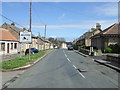
West Street
Looking along the B6349 as it enters Belford.
Image: © DS Pugh
Taken: 26 Jun 2022
0.16 miles
8
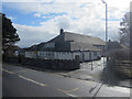
Belford First School
The main entrance to Belford First School, seen from West Street.
Image: © Graham Robson
Taken: 2 Apr 2013
0.16 miles