Expanding Belford
Introduction
The photograph on this page of Expanding Belford by Graham Robson as part of the Geograph project.
The Geograph project started in 2005 with the aim of publishing, organising and preserving representative images for every square kilometre of Great Britain, Ireland and the Isle of Man.

There are currently over 7.5m images from over 14,400 individuals and you can help contribute to the project by visiting https://www.geograph.org.uk
Expanding Belford
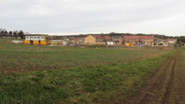
Image: © Graham Robson Taken: 7 Feb 2015
Looking across an oilseed rape crop toward a building site on the edge of Belford. 12 months ago Image shows that the house with the 2 white garage doors was still under construction and where the 4 (or 2 pairs of semi-detached) houses to the right now are was just a patch of mud.
Images are licensed for reuse under creativecommons.org/licenses/by-sa/2.0
Image Location
Latitude
55.593933
Longitude
-1.830826