
IMAGES TAKEN NEAR TO
Warwick Street, NEWCASTLE UPON TYNE, NE6 5AR
Introduction
This page details the photographs taken nearby to Warwick Street, NE6 5AR by members of the Geograph project.
The Geograph project started in 2005 with the aim of publishing, organising and preserving representative images for every square kilometre of Great Britain, Ireland and the Isle of Man.

There are currently over 7.5m images from over14,400 individuals and you can help contribute to the project by visiting https://www.geograph.org.uk
Image Map
Images are licensed for reuse under creativecommons.org/licenses/by-sa/2.0
Notes
- Clicking on the map will re-center to the selected point.
- The higher the marker number, the further away the image location is from the centre of the postcode.
Image Listing (58 Images Found)
Images are licensed for reuse under creativecommons.org/licenses/by-sa/2.0
Image
Details
Distance
1
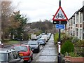
Cycleway in Sandyford, Newcastle
View up Stratford Grove West
Image: © Road Engineer
Taken: 14 Dec 2014
0.06 miles
2
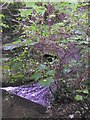
Ouseburn Culvert
The Ouse Burn disappears underground at this point to re-emerge about 400 metres downstream. The steep sided valley in which the stream flowed was filled in after 1907 to a depth of 35 metres by the Ouseburn Tip.
Image: © Oliver Dixon
Taken: 23 Jun 2017
0.07 miles
3
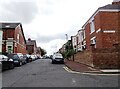
Street junction in Jesmond Vale
Junction of Stratford Grove West with Stratford Road. There is a dense network of terraced house streets in this area.
Image: © Robert Graham
Taken: 15 Jul 2024
0.07 miles
5
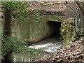
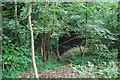
Ouseburn Culvert, Jesmond Vale
The Ouseburn stream disappears into a culvert through which it flows for a few hundred metres under the city stadium park.
Image: © Graham Robson
Taken: 31 Jan 2016
0.08 miles
6
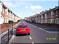
Warwick Street
Looking east up Warwick Street towards Heaton
Image: © Weston Beggard
Taken: 18 Sep 2005
0.08 miles
7
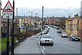
Newington Road in Sandyford, Newcastle
Near the Newcastle City Council Depot
Image: © Road Engineer
Taken: 14 Dec 2014
0.08 miles
8
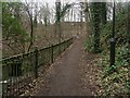
Footpath in Jesmond Vale
A footpath alongside the Ouseburn in Jesmond Vale. To the left the stream disappears into a culvert through which it flows for several hundred metres.
Image: © Graham Robson
Taken: 31 Jan 2016
0.08 miles
9
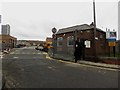
Entrance to Newington Road Council Depot, Newcastle upon Tyne
A large works depot occupied by various branches of Newcastle City Council.
Image: © Graham Robson
Taken: 31 Jan 2016
0.09 miles
10
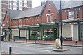
Heaton Perk, Heaton Park Road, Newcastle upon Tyne
Local cafe that does very good cakes and coffee, with free wifi, was doing good trade for a bank holiday Monday.
Image: © hayley green
Taken: 31 Aug 2009
0.09 miles