IMAGES TAKEN NEAR TO
West Thirston, MORPETH, NE65 9EQ
Introduction
This page details the photographs taken nearby to NE65 9EQ by members of the Geograph project.
The Geograph project started in 2005 with the aim of publishing, organising and preserving representative images for every square kilometre of Great Britain, Ireland and the Isle of Man.

There are currently over 7.5m images from over14,400 individuals and you can help contribute to the project by visiting https://www.geograph.org.uk
Image Map
Images are licensed for reuse under creativecommons.org/licenses/by-sa/2.0
Notes
- Clicking on the map will re-center to the selected point.
- The higher the marker number, the further away the image location is from the centre of the postcode.
Image Listing (9 Images Found)
Images are licensed for reuse under creativecommons.org/licenses/by-sa/2.0
Image
Details
Distance
1
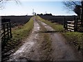
Public Footpath on farm track
Leading to Hemel Farm
Image: © David Clark
Taken: 2 Mar 2010
0.15 miles
2
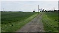
Road to Hemel
Driveway across a field at West Thirston.
Image: © Richard Webb
Taken: 15 May 2015
0.16 miles
3
Stubble, Hemel
A field outside West Thirston.
Image: © Richard Webb
Taken: 15 Sep 2018
0.16 miles
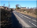
4
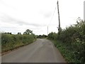
Road between East Thirston and West Thirston
Looking along the B6345 road which connects East Thirston and West Thirston.
Image: © Graham Robson
Taken: 27 Aug 2017
0.17 miles
5
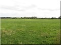
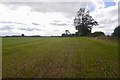
Grass field near West Thirston
An expansive grass field to the south of the village of West Thirston.
Image: © Graham Robson
Taken: 27 Aug 2017
0.17 miles
6
West Thirston
On the B6345 from East Thirston
Image: © David Clark
Taken: 2 Mar 2010
0.17 miles
7
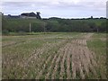
Stubble, Hemel
Looking towards East Thirston.
Image: © Richard Webb
Taken: 15 Sep 2018
0.19 miles
8
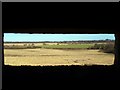
Looking out of West Thirston Pillbox
In a Northerly direction.
Image: © David Clark
Taken: 2 Mar 2010
0.24 miles
9
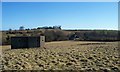
West Thirston Pillbox
With Thirston Mill in the near distance alongside Thirston Burn which runs in front of the trees. Up on the hill is East Thirston.
Image: © David Clark
Taken: 2 Mar 2010
0.25 miles