
IMAGES TAKEN NEAR TO
Charleton Way, MORPETH, NE65 7EE
Introduction
This page details the photographs taken nearby to Charleton Way, NE65 7EE by members of the Geograph project.
The Geograph project started in 2005 with the aim of publishing, organising and preserving representative images for every square kilometre of Great Britain, Ireland and the Isle of Man.

There are currently over 7.5m images from over14,400 individuals and you can help contribute to the project by visiting https://www.geograph.org.uk
Image Map
Images are licensed for reuse under creativecommons.org/licenses/by-sa/2.0
Notes
- Clicking on the map will re-center to the selected point.
- The higher the marker number, the further away the image location is from the centre of the postcode.
Image Listing (25 Images Found)
Images are licensed for reuse under creativecommons.org/licenses/by-sa/2.0
Image
Details
Distance
1
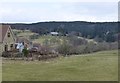
Pasture on the south east edge of Rothbury
Cragside, the home of Lord Armstrong - Victorian inventor, innovator and landscape genius - peeps out from the trees on the right.
Cragside was the first house in the world to be lit by hydroelectricity.
Image: © Russel Wills
Taken: 30 Mar 2013
0.04 miles
2
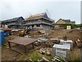
New housing off Garleigh Road
Viewed from Wagtail Road.
Image: © Russel Wills
Taken: 31 Aug 2019
0.04 miles
3

Foundations for more new housing
At the 'top end' of Rothbury.
Image: © Russel Wills
Taken: 31 Aug 2019
0.04 miles
4
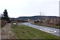
The southerly approach to Rothbury
On the B6342.
Image: © Russel Wills
Taken: 30 Mar 2013
0.07 miles
5

Disused railway approaching Rothbury, Northumberland
Half a mile from the end of the Rothbury branch trains entered a final cutting and passed under this now derelict bridge.
Image: © Ralph Rawlinson
Taken: 5 Feb 2006
0.13 miles
6
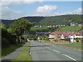
Garleigh Road, Rothbury
A long steep hill into Rothbury from the south. Not to be confused with the road past Cragside which is a longer steeper hill from the north.
Image: © Richard Webb
Taken: 10 Sep 2015
0.14 miles
7
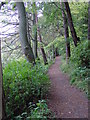
The riverside/woodland path from Rothbury to Thrum Mill.
Image: © Ann Hodgson
Taken: 10 Oct 2004
0.15 miles
8
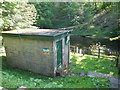
Rothbury Gauging Station
One of the gauging stations which monitor the flow of the River Coquet. There are others at Alwinton and Morwick.
Image: © Paul Franks
Taken: 24 May 2012
0.21 miles
10
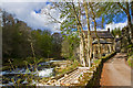
Thrum Mill
Featured on Channel 4's The Restoration Man, Thrum Mill has been the subject of an ongoing major restoration project by its dedicated owners. Scaffolding can be seen all around the mill building.
Image: © Mike Searle
Taken: 9 May 2013
0.22 miles