
IMAGES TAKEN NEAR TO
Harbottle, MORPETH, NE65 7BJ
Introduction
This page details the photographs taken nearby to NE65 7BJ by members of the Geograph project.
The Geograph project started in 2005 with the aim of publishing, organising and preserving representative images for every square kilometre of Great Britain, Ireland and the Isle of Man.

There are currently over 7.5m images from over14,400 individuals and you can help contribute to the project by visiting https://www.geograph.org.uk
Image Map
Images are licensed for reuse under creativecommons.org/licenses/by-sa/2.0
Notes
- Clicking on the map will re-center to the selected point.
- The higher the marker number, the further away the image location is from the centre of the postcode.
Image Listing (40 Images Found)
Images are licensed for reuse under creativecommons.org/licenses/by-sa/2.0
Image
Details
Distance
1
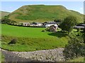
Linbriggs from south bank of River Coquet
The hill above the farm (unnamed) terminates the ridge south-west of Green Side. The old historian of Coquetdale, David Dippie Dixon, describes the hill as follows:
"Far above on the left bank of the river rise lofty cliffs of a great height. The face of this steep acclivity is traversed by 'Passpeth', a perilous path, nothing more than a sheep-track overlooking the linns, to be trod only by those possessed of a sure foot and clear head. It was on these exposed heights that the men of Upper Coquet some three centuries ago had to keep watch, night and day, to guard against the incursions of the Scottish Freebooters."
The old track, now known as Pass Peth Image passes close to the summit.
As at Barrow, to the east, there was once a medieval tower house at Linbriggs, also destroyed by Scottish raiders.
Image: © Andrew Curtis
Taken: 5 Aug 2011
0.00 miles
2
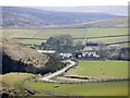
Linbriggs and Linshiels from the north
Showing the bridge over the River Coquet from a similar location to Image
Image: © Andrew Curtis
Taken: 16 Apr 2010
0.01 miles
3
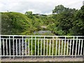
River Coquet from farm bridge north of Linshiels
Looking towards Quickening Cote. There is a view down river here Image
Image: © Andrew Curtis
Taken: 5 Aug 2011
0.03 miles
4

Linbriggs and Linshiels from slopes south-west of Green Side
Image: © Andrew Curtis
Taken: 5 Aug 2011
0.03 miles
5
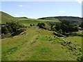
Old trackway between Quickening Cote and Linshiels
The track ascends the ridge between the River Coquet (seen ahead to the left) and Ridlees Burn. It was the main route through the valley, leading down to a ford over the River Coquet, before the building of the road bridge north of Linbriggs.
Image: © Andrew Curtis
Taken: 5 Aug 2011
0.05 miles

7
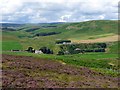
Linshiels, Quickening Cote and Linbriggs from the east
"Adieu to thee, Linn-shiels sae rough! amang thy beetlin' scaurs,
Aneath the beams the laughin' streams may sparkle an' may play;
Now bright in sun, now dark in shade, the water as it wars,
Through rifted craig an' flood-worn cliff its journey and its way.
As owre each linn, wi' gleesome din, the streams come gurglin' gay,
There let the troller wave his gad an' strike "the mennim" fain,
For soon the floods o' winter wild shall roar frae bank to brae:
And this maun be, dear Coquet-side, or ere I come again!"
The Angler's Adieu for the Season. The Coquetdale Fishing Songs. Thomas Doubleday ed. (1852).
Image: © Andrew Curtis
Taken: 5 Aug 2011
0.05 miles
8
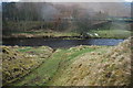
Ford at Linshiels
This ford on the River Coquet is found at Linshiels.
Image: © John Walton
Taken: 11 Mar 2015
0.07 miles
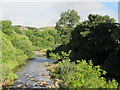
10
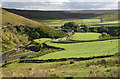
Linbrigs
Linbrigs in Upper Coquetdale.
Image: © Peter McDermott
Taken: 12 Sep 2010
0.08 miles