
Linbriggs from south bank of River Coquet
Introduction
The photograph on this page of Linbriggs from south bank of River Coquet by Andrew Curtis as part of the Geograph project.
The Geograph project started in 2005 with the aim of publishing, organising and preserving representative images for every square kilometre of Great Britain, Ireland and the Isle of Man.

There are currently over 7.5m images from over 14,400 individuals and you can help contribute to the project by visiting https://www.geograph.org.uk
Linbriggs from south bank of River Coquet
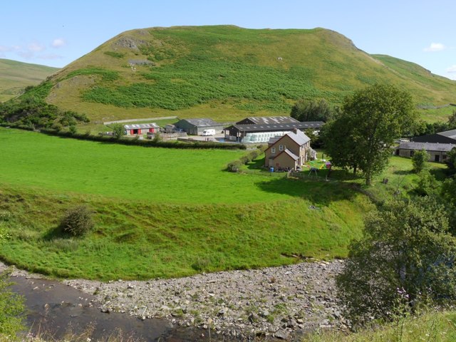
Image: © Andrew Curtis Taken: 5 Aug 2011
The hill above the farm (unnamed) terminates the ridge south-west of Green Side. The old historian of Coquetdale, David Dippie Dixon, describes the hill as follows: "Far above on the left bank of the river rise lofty cliffs of a great height. The face of this steep acclivity is traversed by 'Passpeth', a perilous path, nothing more than a sheep-track overlooking the linns, to be trod only by those possessed of a sure foot and clear head. It was on these exposed heights that the men of Upper Coquet some three centuries ago had to keep watch, night and day, to guard against the incursions of the Scottish Freebooters." The old track, now known as Pass Peth Image passes close to the summit. As at Barrow, to the east, there was once a medieval tower house at Linbriggs, also destroyed by Scottish raiders.
Images are licensed for reuse under creativecommons.org/licenses/by-sa/2.0
Image Location

Latitude
55.350512
Longitude
-2.17218