
IMAGES TAKEN NEAR TO
High Street, MORPETH, NE65 0LS
Introduction
This page details the photographs taken nearby to High Street, NE65 0LS by members of the Geograph project.
The Geograph project started in 2005 with the aim of publishing, organising and preserving representative images for every square kilometre of Great Britain, Ireland and the Isle of Man.

There are currently over 7.5m images from over14,400 individuals and you can help contribute to the project by visiting https://www.geograph.org.uk
Image Map
Images are licensed for reuse under creativecommons.org/licenses/by-sa/2.0
Notes
- Clicking on the map will re-center to the selected point.
- The higher the marker number, the further away the image location is from the centre of the postcode.
Image Listing (53 Images Found)
Images are licensed for reuse under creativecommons.org/licenses/by-sa/2.0
Image
Details
Distance
1
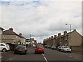
Albert Street A1068 the main road into Amble
The coastal route
Image: © Martin Dawes
Taken: 22 Jul 2015
0.01 miles
2
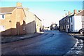
The Top of High Street
in Amble, to the left, going down hill is The Wynd.
Image: © David Clark
Taken: 18 Jan 2010
0.01 miles
3
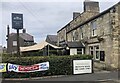
Wellwood Arms
Public House on the High Street, Amble
Image: © Eirian Evans
Taken: 14 Sep 2021
0.01 miles
4
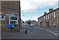
The A1068 through Amble
At the junction of Albert Street and High Street.
Image: © Barbara Carr
Taken: 8 Oct 2013
0.02 miles
5
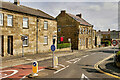
Amble High Street
Amble is a town at the mouth of the River Coquet, on the North Sea coast of Northumberland.
Image: © David Dixon
Taken: 22 May 2021
0.03 miles
6
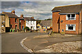
Amble, The Wynd
Amble is a town at the mouth of the River Coquet, on the North Sea coast of Northumberland.
Image: © David Dixon
Taken: 22 May 2021
0.03 miles
7

Benchmark, 26 The Wynd, Amble
Detail of the Ordnance Survey cut benchmark on the east angle of 26 The Wynd, Amble, facing onto West Avenue (location photograph Image).
The benchmark is not on the Ordnance Survey Database, but is shown on the 1:10,560 Ordnance Survey map published in 1960 as marking a height of 48.74 feet above mean sea level (Ordnance Datum Newlyn).
Image: © Adrian Taylor
Taken: 12 Apr 2025
0.04 miles
8
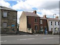
The top of The Wynd
The small street between the houses is Gloster Terrace and leads to the Masonic Hall. Number 22, the red brick house adjacent to Gloster Terrace was once called Myrtle House.
Image: © Adrian Taylor
Taken: 29 Jul 2007
0.04 miles
9
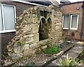
Section of 15th Century Manor House wall
All that remains of the Manor House, in a rather cramped location, in the well kept Calvary garden of the Catholic Church of Sacred Heart and St Cuthbert. Grade II listed.
https://historicengland.org.uk/listing/the-list/list-entry/1238551?section=official-list-entry
Image: © Leanmeanmo
Taken: 13 Nov 2022
0.04 miles
10
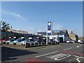
Fuel filling station, Amble
A fuel filling station and used car dealers on Albert Street in Amble.
Image: © Graham Robson
Taken: 11 Sep 2015
0.05 miles