IMAGES TAKEN NEAR TO
Station Cottages, MORPETH, NE65 0DS
Introduction
This page details the photographs taken nearby to Station Cottages, NE65 0DS by members of the Geograph project.
The Geograph project started in 2005 with the aim of publishing, organising and preserving representative images for every square kilometre of Great Britain, Ireland and the Isle of Man.

There are currently over 7.5m images from over14,400 individuals and you can help contribute to the project by visiting https://www.geograph.org.uk
Image Map
Images are licensed for reuse under creativecommons.org/licenses/by-sa/2.0
Notes
- Clicking on the map will re-center to the selected point.
- The higher the marker number, the further away the image location is from the centre of the postcode.
Image Listing (211 Images Found)
Images are licensed for reuse under creativecommons.org/licenses/by-sa/2.0
Image
Details
Distance
2
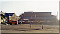
Near site of former station at Amble, 1991
The open space is near, but unfortunately not quite where, the terminus of the ex-NER branch from Chevington was situated. Actually, tracks passed the station to reach the Docks. Regular passenger services ceased from 7/7/30, but excursions came until 1939, while coal traffic to the staithes kept the branch in operation until 6/10/69.
Image: © Ben Brooksbank
Taken: 6 Sep 1991
0.04 miles
3

Fourways, Amble
Crossroads in the centre of Amble. The Newcastle to Alnwick bus comes to here and then turns round and goes back up the road and on to Warkworth.
Image: © Robert Graham
Taken: 4 Jul 2012
0.04 miles
4
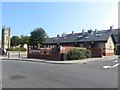
Tourist Information Centre and public toilets, Amble
The building close to the town's town square contains a tourist information office and public toilets.
Image: © Graham Robson
Taken: 11 Sep 2015
0.05 miles
5
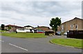
Amble Community Sports Development Centre
Formerly The Amble Boys Club. (White building to left of 'photo.Situated of the roundabout that joins Percy Drive (in front of photographer) with Percy Street and Church Street.
Image: © David Clark
Taken: 3 Jun 2014
0.06 miles
6
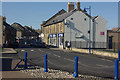
Queen Street, Amble
Amble's main street seen from the Town Square.
Image: © Stephen McKay
Taken: 4 Sep 2011
0.06 miles
8
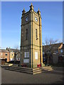
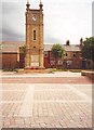
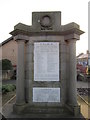
Amble War Memorial
This unusually impressive war memorial was unveiled in 1925.
Image: © Stephen McKay
Taken: 4 Sep 2011
0.07 miles
9
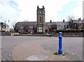
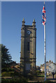
Clock Tower War Memorial, Amble
The Clock Tower in Amble Town Square was unveiled as a World War I memorial in 1925. It was designed by Will Burton, council surveyor.
https://historicengland.org.uk/listing/the-list/list-entry/1041896
Image: © Andrew Curtis
Taken: 22 Apr 2012
0.07 miles