Near site of former station at Amble, 1991
Introduction
The photograph on this page of Near site of former station at Amble, 1991 by Ben Brooksbank as part of the Geograph project.
The Geograph project started in 2005 with the aim of publishing, organising and preserving representative images for every square kilometre of Great Britain, Ireland and the Isle of Man.

There are currently over 7.5m images from over 14,400 individuals and you can help contribute to the project by visiting https://www.geograph.org.uk
Near site of former station at Amble, 1991
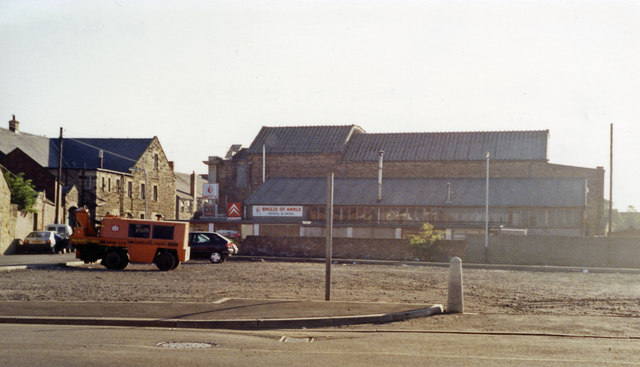
Image: © Ben Brooksbank Taken: 6 Sep 1991
The open space is near, but unfortunately not quite where, the terminus of the ex-NER branch from Chevington was situated. Actually, tracks passed the station to reach the Docks. Regular passenger services ceased from 7/7/30, but excursions came until 1939, while coal traffic to the staithes kept the branch in operation until 6/10/69.
Images are licensed for reuse under creativecommons.org/licenses/by-sa/2.0
Image Location
Latitude
55.33392
Longitude
-1.580506