IMAGES TAKEN NEAR TO
Woodhead Road, NEWCASTLE UPON TYNE, NE6 4RX
Introduction
This page details the photographs taken nearby to Woodhead Road, NE6 4RX by members of the Geograph project.
The Geograph project started in 2005 with the aim of publishing, organising and preserving representative images for every square kilometre of Great Britain, Ireland and the Isle of Man.

There are currently over 7.5m images from over14,400 individuals and you can help contribute to the project by visiting https://www.geograph.org.uk
Image Map (Loading...)


Getting Data...Please wait
Leaflet Map data © OpenStreetMap
Images are licensed for reuse under creativecommons.org/licenses/by-sa/2.0
Notes
- Clicking on the map will re-center to the selected point.
- The higher the marker number, the further away the image location is from the centre of the postcode.
Image Listing (27 Images Found)
Images are licensed for reuse under creativecommons.org/licenses/by-sa/2.0
Image
Details
Distance
1
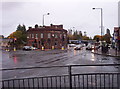
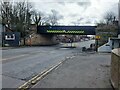
Walkergate Crossroads
View looking east along Shields Road to the right, and up Benfield Road to the left. The actual railway that lends its name to the pub can be seen crossing Benfield Road via the metal bridge at the extreme left of the picture.
Image: © Weston Beggard
Taken: 22 Oct 2005
0.06 miles
2
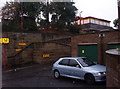
Walkergate Metro Station
This used to be the old BR station until the Metro took over this section of track in the early 80's.
Image: © Weston Beggard
Taken: 22 Oct 2005
0.06 miles
3
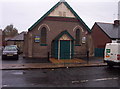
Ambassador Hall
A 'Church of God' meeting place on Coutts Road, Walkergate.
Image: © Weston Beggard
Taken: 22 Oct 2005
0.06 miles
6
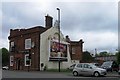
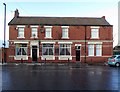
Railway Hotel, Shields Road, Walkergate
Newcastle Libraries have a photo of the pub from 1967 on Flickr: https://www.flickr.com/photos/newcastlelibraries/4078687662/in/photostream
Image: © Andrew Curtis
Taken: 18 Jan 2018
0.12 miles
8
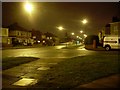
Fossway, Walkergate
From the corner with Baret Road.
Image: © Stephen Sweeney
Taken: 7 Jan 2009
0.14 miles
9
Walkergate Metro Station
The southern limb of the coastal loop of the Tyne and Wear Metro passes over Benfield Road at Walkergate Station.
Image: © Oliver Dixon
Taken: 14 Mar 2023
0.14 miles
10
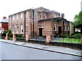
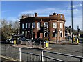
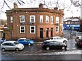
Wolsingham Hotel, Shields Road, Walkergate
The hotel was rebuilt in 1902. Now known simply as 'The Wolsey'. Offers 10% off the food bill for cyclists completing the Coast to Coast (C2C).
Image: © Andrew Curtis
Taken: 18 Jan 2018
0.14 miles