1
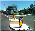
Broomfield Avenue, Walkerville
Semi-detached bungalows on both sides of a residential street in Walkerville.
Image: © Graham Robson
Taken: 4 Jul 2020
0.06 miles
2
Disused land, Benfield Road, Walkergate
The former site of the Walkergate Hospital. The long cleared site now has a green, grassy cover.
Image: © Graham Robson
Taken: 20 Mar 2020
0.07 miles
3
Walkergate Park Neuro Rehabilitation Centre, Benfield Road, Walkergate
A specialist centre for the care and treatment of people suffering from brain, spinal cord and muscle injuries.
Image: © Graham Robson
Taken: 20 Mar 2020
0.11 miles
4
Wing of Walkergate Hospital
Walkergate Hospital lies on the west side of Benfield Road, opposite Benfield School on the eastern side of Newcastle upon Tyne.
Image: © Trevor Littlewood
Taken: 20 Mar 2013
0.14 miles
5
Convenience store, Appletree Gardens, Walkerville, Newcastle upon Tyne
The Booze 'N' Food convenience store at the western end of Appletree Gardens in Walkerville.
Image: © Graham Robson
Taken: 4 Jul 2020
0.16 miles
6
Appletree Gardens
Residential street off Benfield Road. Larchwood Avenue branches off to the right.
Image: © Oliver Dixon
Taken: 14 Mar 2023
0.17 miles
7
Appletree Gardens, Walkergate
Image: © Alex McGregor
Taken: 28 May 2012
0.17 miles
8
Road to Benfield Business Park
Image: © Anthony Foster
Taken: 18 Feb 2024
0.18 miles
9
Larchwood Avenue, Walkerville
Semi detached houses on the southern side of Larchwood Avenue in Walkerville. The ground floors of the pair nearest the camera serve as shops. One of them, a hairdresser is open for the first time since mid March due to government imposed rules which forced the closure of non essential businesses as a response to the COVID-19 outbreak which had affected the country.
Image: © Graham Robson
Taken: 4 Jul 2020
0.19 miles
10
Walkergate Metro Station
Appletree Gardens' junction with Benfield Road.
Image: © Richard Webb
Taken: 1 Oct 2015
0.19 miles


