IMAGES TAKEN NEAR TO
Bath Street, NEWCASTLE UPON TYNE, NE6 3PH
Introduction
This page details the photographs taken nearby to Bath Street, NE6 3PH by members of the Geograph project.
The Geograph project started in 2005 with the aim of publishing, organising and preserving representative images for every square kilometre of Great Britain, Ireland and the Isle of Man.

There are currently over 7.5m images from over14,400 individuals and you can help contribute to the project by visiting https://www.geograph.org.uk
Image Map
Images are licensed for reuse under creativecommons.org/licenses/by-sa/2.0
Notes
- Clicking on the map will re-center to the selected point.
- The higher the marker number, the further away the image location is from the centre of the postcode.
Image Listing (33 Images Found)
Images are licensed for reuse under creativecommons.org/licenses/by-sa/2.0
Image
Details
Distance
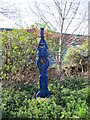
1
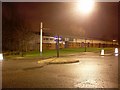
Small roundabout east of Walker
On Waverdale Avenue at Wellbeck Road.
Image: © Stephen Sweeney
Taken: 7 Jan 2009
0.03 miles
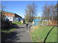
2
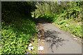
Hadrian's Wall Path near Walker
This stretch is notable for the quantity of litter along it.
Image: © Bill Boaden
Taken: 20 Apr 2017
0.05 miles
6
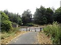
Hadrian's Wall Path crossing Welbeck Road
In Low Walker. At some of these crossing points of the old railway, the bridges have been demolished, presumably to abolish maintenance costs.
Image: © Robert Graham
Taken: 24 Jul 2013
0.06 miles
7
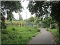
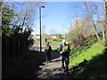
Cycle /foot path, Walker
The path along Hadrian's Wall run southwards along the Tyne towards Newcastle city centre. Here it uses an old Riverside Branch railway trackbed.
Image: © Richard Webb
Taken: 31 Jul 2012
0.07 miles
8

Newcastle's old railway relics II
These concrete bridge abutments carried the North Eastern Railway Riverside Branch over Welbeck Road in Low Walker. The line closed in 1973.
Image: © Bobby Clegg
Taken: 21 Jun 2014
0.07 miles
9
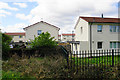
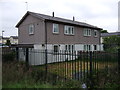
Housing in Walker
As seen from the Hadrian's Wall Path.
Image: © Bill Boaden
Taken: 20 Apr 2017
0.09 miles