
IMAGES TAKEN NEAR TO
Raby Crescent, NEWCASTLE UPON TYNE, NE6 2FD
Introduction
This page details the photographs taken nearby to Raby Crescent, NE6 2FD by members of the Geograph project.
The Geograph project started in 2005 with the aim of publishing, organising and preserving representative images for every square kilometre of Great Britain, Ireland and the Isle of Man.

There are currently over 7.5m images from over14,400 individuals and you can help contribute to the project by visiting https://www.geograph.org.uk
Image Map
Images are licensed for reuse under creativecommons.org/licenses/by-sa/2.0
Notes
- Clicking on the map will re-center to the selected point.
- The higher the marker number, the further away the image location is from the centre of the postcode.
Image Listing (147 Images Found)
Images are licensed for reuse under creativecommons.org/licenses/by-sa/2.0
Image
Details
Distance
1
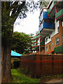
Byker Wall
The Shipley Rise section of this most iconic of housing developments, seen from Raby Way.
Image: © Stephen McKay
Taken: 9 Aug 2019
0.02 miles
2
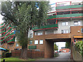
Byker Wall
A section of the 'wall' where it crosses Raby Way.
Image: © Stephen McKay
Taken: 9 Aug 2019
0.02 miles

4

Dalton Crescent, Byker Wall
Eight-storey block in the Kendal sector.
Image: © Andrew Curtis
Taken: 28 Mar 2010
0.04 miles
5

The Byker Wall
Part of a futuristic and controversial housing scheme of the 1970s.
Image: © Dr Neil Clifton
Taken: 27 Oct 1979
0.05 miles
6

Brinkburn Street, Byker Estate
The old building at the top of the lane is Shipley Street Baths. It is integrated into the Byker Wall and was used initially to provide heating for the estate.
Image: © Andrew Curtis
Taken: 28 Mar 2010
0.06 miles
7

Shields Road Bypass
View looking down Shields Road Bypass in Byker.
Image: © Peter McDermott
Taken: 23 Aug 2008
0.06 miles
8

Byker Metro station, Newcastle upon Tyne
This concourse has become a venue for artists, local and community in the main. This piece is quite new (often pieces do get damaged and you can see where this one has been ripped) and the colours are really vibrant against the station interior
Image: © hayley green
Taken: 31 Aug 2009
0.06 miles
9

The A193 north of Byker Wall
Bypass for Shields Road built in the late 1980s.
Image: © Andrew Curtis
Taken: 28 Mar 2010
0.06 miles
10

Cheviot Mount
Short, low-rise terrace blocks on steep ground with views of the City.
Image: © Andrew Curtis
Taken: 28 Mar 2010
0.07 miles