
IMAGES TAKEN NEAR TO
Mitford, MORPETH, NE61 3PL
Introduction
This page details the photographs taken nearby to NE61 3PL by members of the Geograph project.
The Geograph project started in 2005 with the aim of publishing, organising and preserving representative images for every square kilometre of Great Britain, Ireland and the Isle of Man.

There are currently over 7.5m images from over14,400 individuals and you can help contribute to the project by visiting https://www.geograph.org.uk
Image Map
Images are licensed for reuse under creativecommons.org/licenses/by-sa/2.0
Notes
- Clicking on the map will re-center to the selected point.
- The higher the marker number, the further away the image location is from the centre of the postcode.
Image Listing (56 Images Found)
Images are licensed for reuse under creativecommons.org/licenses/by-sa/2.0
Image
Details
Distance
2

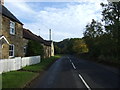
Ford at Mitford
This is the third of the three Mitford fords. This one is on the River Wansbeck just after joining the River Font.
Image: © John Walton
Taken: 12 Mar 2015
0.05 miles
3

Junction of the River Font and River Wansbeck
Image: © Andrew Curtis
Taken: 12 Nov 2010
0.06 miles
4

Sign Post to Pigdon
Situated at the bottom of St. Leonard's Road. The road that leads past the site of St Leonard's Hospital somewhere in the vicinity of Spital Hill.
http://www.keystothepast.info/durhamcc/K2P.nsf/K2PDetail?readform&PRN=N11071
Image: © David Clark
Taken: 23 Mar 2010
0.08 miles
5
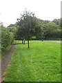
Millennium trees, Mitford
A line of trees on the edge of Mitford which were planted to mark the Millennium, in October 2000. Image and Image show a nearby stone which was placed to mark the event.
Image: © Graham Robson
Taken: 20 Aug 2017
0.09 miles
6

Direction Sign ? Signpost on St Leonards Lane, Mitford
Located on the northeast side of the junction of the B6343 and St Leonards Lane in Mitford parish. 1 arm and fan finial. See also https://www.geograph.org.uk/photo/6527519 and https://www.geograph.org.uk/photo/1767673.
Milestone Society National ID: NB_NZ1785
Image: © R Barron
Taken: 31 Mar 2022
0.09 miles
7

Direction Sign ? Signpost on St Leonards Lane, Mitford
Located on the northeast side of the junction of the B6343 and St Leonards Lane in Mitford parish. 1 arm and fan finial. See also https://www.geograph.org.uk/photo/1767673.
Milestone Society National ID: NB_NZ1785
Image: © A Lloyd
Taken: 28 Jan 2019
0.09 miles
8
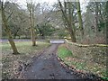
The original road to St Leonard's Hospital
This shows the line of the original track to Pigdon via St Leonard's road. The modern B6343 can be seen running across the Picture, east to west. The tarmacadam road to Pigdon runs uphill towards you just out of the photo to the left. The gap in the estate wall can be seen where the track joins the B road. It certainly looks as if this track is in regular use, probably by farm vehicles cutting off the sharp egress from the B6343.
Image: © David Clark
Taken: 23 Mar 2010
0.09 miles
9
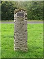
Standing stone with plaque, Mitford
A standing stone carrying an inscribed plaque commemorating the planting of an adjacent line of trees to mark the Millennium in 2000.
Image: © Graham Robson
Taken: 20 Aug 2017
0.10 miles
10
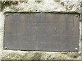
Commemorative plaque, Mitford
A plaque attached to an inscribed stone Image to commemorate the planting of an adjacent line of trees to mark the Millennium.
Image: © Graham Robson
Taken: 20 Aug 2017
0.10 miles