
IMAGES TAKEN NEAR TO
Harelaw Grove, NEWCASTLE UPON TYNE, NE5 5EB
Introduction
This page details the photographs taken nearby to Harelaw Grove, NE5 5EB by members of the Geograph project.
The Geograph project started in 2005 with the aim of publishing, organising and preserving representative images for every square kilometre of Great Britain, Ireland and the Isle of Man.

There are currently over 7.5m images from over14,400 individuals and you can help contribute to the project by visiting https://www.geograph.org.uk
Image Map
Images are licensed for reuse under creativecommons.org/licenses/by-sa/2.0
Notes
- Clicking on the map will re-center to the selected point.
- The higher the marker number, the further away the image location is from the centre of the postcode.
Image Listing (15 Images Found)
Images are licensed for reuse under creativecommons.org/licenses/by-sa/2.0
Image
Details
Distance
2
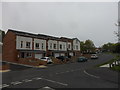
New housing, The Burnside, West Denton
Built on the site of the former John Gilpin pub Image]
Image: © Anthony Foster
Taken: 7 May 2016
0.13 miles
3
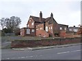
Another pub closed!
The John Gilpin on the Burnside in West Denton looking very forlorn.
Image: © Oliver Dixon
Taken: 1 Feb 2013
0.14 miles
4
Path between The Roman Way and Western Avenue, NE15
Image: © Mike Quinn
Taken: 1 Nov 2011
0.14 miles
5
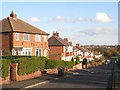
The Roman Way, NE15
The road lies on the line of Hadrian's Wall - see the map and satellite image http://openspace.nearby.org.uk/wheresthepath.htm?lat=54.98806422683588&lon=-1.7066949605941772&gz=18&oz=10>=1.
Image: © Mike Quinn
Taken: 1 Nov 2011
0.15 miles
8
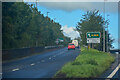
Newburn : A69
The road heads off the A69.
Image: © Lewis Clarke
Taken: 25 Sep 2020
0.20 miles
9
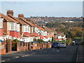
The Roman Way, NE15 (2)
The road lies on the line of Hadrian's Wall - see the map and satellite image http://openspace.nearby.org.uk/wheresthepath.htm?lat=54.98857206377767&lon=-1.7098653316497802&gz=17&oz=10>=1.
Image: © Mike Quinn
Taken: 1 Nov 2011
0.20 miles
10
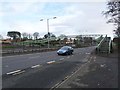
Footbridge over the A69
Footbridge linking the two halves of West Denton over the busy A69, Newcastle to Carlisle road. As all ramps up to the bridge are stepped, it is not a very easy route for cyclists.
Image: © Oliver Dixon
Taken: 1 Feb 2013
0.22 miles