
IMAGES TAKEN NEAR TO
Antrim Close, NEWCASTLE UPON TYNE, NE5 3UG
Introduction
This page details the photographs taken nearby to Antrim Close, NE5 3UG by members of the Geograph project.
The Geograph project started in 2005 with the aim of publishing, organising and preserving representative images for every square kilometre of Great Britain, Ireland and the Isle of Man.

There are currently over 7.5m images from over14,400 individuals and you can help contribute to the project by visiting https://www.geograph.org.uk
Image Map
Images are licensed for reuse under creativecommons.org/licenses/by-sa/2.0
Notes
- Clicking on the map will re-center to the selected point.
- The higher the marker number, the further away the image location is from the centre of the postcode.
Image Listing (16 Images Found)
Images are licensed for reuse under creativecommons.org/licenses/by-sa/2.0
Image
Details
Distance
1
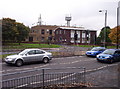
Antennae at Kenton Telephone Exchange
Various antennae and radio masts adorn the roof of Kenton Telephone Exchange. The antennae are for point-to-point microwave communications for telephony networks, and the unusual pronged one is a cellular radio mast. The building closest to the road predated British Telecom, so would have been General Post Office property originally. It housed the old electromechanical exchange (Strowger type) and also the main distribution frame where all the external cables terminated, whilst the new building housed the TXE4 electronic exchange. Thanks to various contributors for additional information.
Image: © Weston Beggard
Taken: 23 Oct 2005
0.07 miles
2
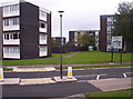
Flats at Kenton Bar
A collection of blocks at Kenton Bar roundabout.
Image: © Weston Beggard
Taken: 23 Oct 2005
0.07 miles
3
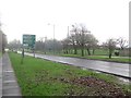
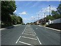
Ponteland Road, Newcastle upon Tyne
Looking along a quiet Ponteland Road in the direction of travel towards the city centre. The dual carriageway is one of the main routes into the city centre from the north.
Image: © Graham Robson
Taken: 10 Jan 2016
0.08 miles
4
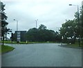
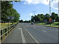
Housing on Ponteland Road (A167)
At the Kenton Bar roundabout.
Image: © Barbara Carr
Taken: 15 Sep 2013
0.08 miles
7
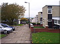
Kenton Bar
Unusual housing at Kenton Bar
Image: © Weston Beggard
Taken: 23 Oct 2005
0.18 miles
9
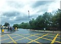
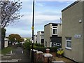
Hazeldene Avenue, Kenton
At its junction with Kenton Lane.
Image: © Barbara Carr
Taken: 15 Sep 2013
0.19 miles
10
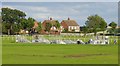
Skate bmx park
New skate/bmx park built with the help of Barclays bank part of a scheme to helpinner city kids keep fit. Very popular with local kids.
Image: © Newbiggin Hall Scouts
Taken: 7 Jul 2007
0.20 miles