
IMAGES TAKEN NEAR TO
Bellingham, HEXHAM, NE48 2LA
Introduction
This page details the photographs taken nearby to NE48 2LA by members of the Geograph project.
The Geograph project started in 2005 with the aim of publishing, organising and preserving representative images for every square kilometre of Great Britain, Ireland and the Isle of Man.

There are currently over 7.5m images from over14,400 individuals and you can help contribute to the project by visiting https://www.geograph.org.uk
Image Map
Images are licensed for reuse under creativecommons.org/licenses/by-sa/2.0
Notes
- Clicking on the map will re-center to the selected point.
- The higher the marker number, the further away the image location is from the centre of the postcode.
Image Listing (20 Images Found)
Images are licensed for reuse under creativecommons.org/licenses/by-sa/2.0
Image
Details
Distance
1
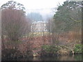
Hesleyside from across the River North Tyne
Image: © Les Hull
Taken: 8 Mar 2006
0.01 miles
3
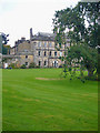
Hesleyside Hall
Home of the Charlton Family. Built in 1719, on the site of an earlier c14 tower house.
Image: © Bill Cresswell
Taken: 25 Sep 2008
0.02 miles
4
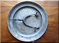
The Charlton Spur
The Story of the Spur.
When the 'Border Reiving' Charlton family assembled for a meal,the lady of the house brought in a salver, but if when the lid was lifted it revealed not the expected roast, but a riding spur, it was a hint for the menfolk to get out and
get reiving (cattle stealing), if they want to eat !
This scene is portrayed in a well known painting in Wallington Hall, Northumberland
Image: © Bill Cresswell
Taken: 25 Sep 2008
0.03 miles
5
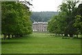
Hesleyside Hall
Hesleyside Hall near Bellingham. Built in 1719, this country house is the seat of the Charlton family.
Image: © Peter McDermott
Taken: 2 Jun 2007
0.03 miles

7
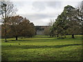
Hesleyside Hall and Park
This landscape park was created in around 1776 and covers about 20 hectares. Although it dates to the period when Capability Brown was working, Hesleyside is not attributed to him. The original plans for the garden included five avenues and a scheme to re-channel the Hesley Burn. Three of these avenues exist today and are planted with chestnut, lime and possibly sycamore. Other elements of the park include a walled garden and woodland. There are also remains of an early formal garden layout which may date to the early 18th century. The terrace, garden walls, gate piers, gates and forecourt walls are all Grade II Listed Buildings protected by law. This is a Grade II registered garden.
http://www.keystothepast.info/durhamcc/K2P.nsf/K2PDetail?readform&PRN=N8000
This is a country house, built in 1719 with later alterations and an earlier core. It stands on or near the site of a 14th century tower house and it has been suggested that part of a wall of the tower is incorporated in the present building. This is a Grade II* Listed Building protected by law.
http://www.keystothepast.info/durhamcc/K2P.nsf/K2PDetail?readform&PRN=N7973
Image: © Les Hull
Taken: 14 Nov 2012
0.04 miles
8
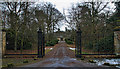
Hesleyside
The entrance to Hesleyside Hall.
Image: © Peter McDermott
Taken: 7 Feb 2009
0.06 miles
9
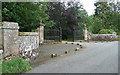
Gates near Bellingham
The entrance to Hesleyside, dating from the early C19th. The elaborate wrought-iron gates are flanked by piers, topped by urn finials, which are, in turn, flanked by serpentine walls culminating in square piers. Grade II listed.
A sign nailed to a nearby tree tells us that, "the house has been the home of the Charlton family since 1343", and that, "the family are happy to welcome parties of visitors to the house by prior arrangement".
Image: © Stephen Richards
Taken: Unknown
0.06 miles
10
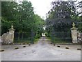
Gateway to Hesleyside
Hesleyside is a magnificent historic family home set within grounds landscaped by Capability Brown and located in the heart of the Northumberland National Park.
Image: © Russel Wills
Taken: 10 Sep 2014
0.06 miles