IMAGES TAKEN NEAR TO
Sparty Lea, HEXHAM, NE47 9UR
Introduction
This page details the photographs taken nearby to NE47 9UR by members of the Geograph project.
The Geograph project started in 2005 with the aim of publishing, organising and preserving representative images for every square kilometre of Great Britain, Ireland and the Isle of Man.

There are currently over 7.5m images from over14,400 individuals and you can help contribute to the project by visiting https://www.geograph.org.uk
Image Map
Images are licensed for reuse under creativecommons.org/licenses/by-sa/2.0
Notes
- Clicking on the map will re-center to the selected point.
- The higher the marker number, the further away the image location is from the centre of the postcode.
Image Listing (40 Images Found)
Images are licensed for reuse under creativecommons.org/licenses/by-sa/2.0
Image
Details
Distance
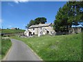
4
Thorneyknowe Quarry (disused)
Ideal for black rubbish sacks and wheelie bins, much easier for the bin lorries.
Image: © Les Hull
Taken: 3 Jul 2019
0.04 miles
5
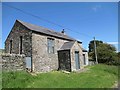
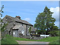
Swinhope Methodist Chapel
This simple and functional building was built in 1845 and remodelled in 1884. It remained in use as a Primitive Methodist chapel until the 1960s and was converted to a private house in the 1990s. It is rectangular in plan with a central porch and a smaller block on the right side that was probably used by the Sunday school. This chapel was used as a meeting place by striking miners in 1849. As a result of the strike many miners were told they could never work in this area again and about 60 people emigrated from East Allendale to Illinois, USA. The chapel accounts book records parting gifts made at this time. This is a Grade II Listed Building protected by law.
http://www.keystothepast.info/article/10339/Site-Details?PRN=N7104
Image: © Les Hull
Taken: 3 Jul 2019
0.05 miles
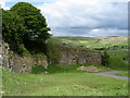
6
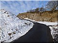
Old quarry in Swinhope
The road up the Swinhope valley winds its way past an old quarry.
Image: © Oliver Dixon
Taken: 8 Feb 2013
0.07 miles
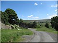
7
The Swinhope valley around Thorney Knowe
Image: © Mike Quinn
Taken: 18 Jun 2012
0.08 miles
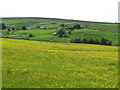
8

Houses in the Swinhope valley
A tributary of East Allendale.
Image: © Oliver Dixon
Taken: 8 Feb 2013
0.08 miles
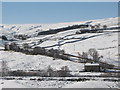
9

The snowy Swinhope Valley below Thorney Knowe
The highest of the buildings (left - one with snow on its roof)) are the Image
Image: © Mike Quinn
Taken: 2 Mar 2010
0.09 miles
10
Snowy East Allen Dale at Spartylea
Looking down from near the T junction towards the River East Allen and the Image, and beyond towards Elpha Green and Swin Hope.
Image: © Mike Quinn
Taken: 2 Mar 2010
0.09 miles