IMAGES TAKEN NEAR TO
Bardon Mill, HEXHAM, NE47 7EX
Introduction
This page details the photographs taken nearby to NE47 7EX by members of the Geograph project.
The Geograph project started in 2005 with the aim of publishing, organising and preserving representative images for every square kilometre of Great Britain, Ireland and the Isle of Man.

There are currently over 7.5m images from over14,400 individuals and you can help contribute to the project by visiting https://www.geograph.org.uk
Image Map
Images are licensed for reuse under creativecommons.org/licenses/by-sa/2.0
Notes
- Clicking on the map will re-center to the selected point.
- The higher the marker number, the further away the image location is from the centre of the postcode.
Image Listing (19 Images Found)
Images are licensed for reuse under creativecommons.org/licenses/by-sa/2.0
Image
Details
Distance
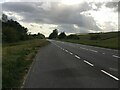
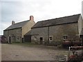
1
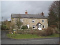
Carrsgate East (Melkridge)
A late 18th century house and former byre, with 19th century additions. This is a Grade II Listed Building protected by law.
http://www.keystothepast.info/durhamcc/K2P.nsf/K2PDetail?readform&PRN=N13552
Image: © Les Hull
Taken: 24 Mar 2010
0.03 miles
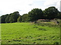
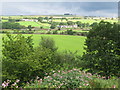
2
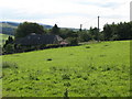
Pastures and woodland east of Carrsgate (2)
Image: © Mike Quinn
Taken: 26 Aug 2010
0.04 miles
6
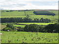
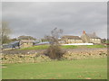
Farmland northeast of Woodhall
Image: © Mike Quinn
Taken: 26 Aug 2010
0.12 miles
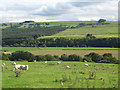
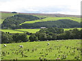
9
The valley of the River South Tyne between Shankfoot and Woodhall (2)
Image: © Mike Quinn
Taken: 12 Aug 2010
0.16 miles