IMAGES TAKEN NEAR TO
Steel, HEXHAM, NE47 0HN
Introduction
This page details the photographs taken nearby to NE47 0HN by members of the Geograph project.
The Geograph project started in 2005 with the aim of publishing, organising and preserving representative images for every square kilometre of Great Britain, Ireland and the Isle of Man.

There are currently over 7.5m images from over14,400 individuals and you can help contribute to the project by visiting https://www.geograph.org.uk
Image Map
Images are licensed for reuse under creativecommons.org/licenses/by-sa/2.0
Notes
- Clicking on the map will re-center to the selected point.
- The higher the marker number, the further away the image location is from the centre of the postcode.
Image Listing (28 Images Found)
Images are licensed for reuse under creativecommons.org/licenses/by-sa/2.0
Image
Details
Distance
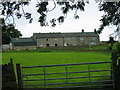
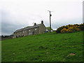
2
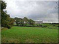
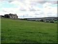
Viewley Farm
Remote farm high above the valley of the Devil's Water on the edge of Slaley Forest.
Image: © Oliver Dixon
Taken: 16 Oct 2010
0.01 miles
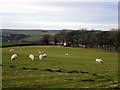
8
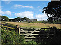
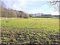
Gate to field with Viewley above
The farm at Viewley lies on the eastern slope in the valley of Devil's Water. The field inside the gate is unkempt rough grazing as is much of the land about the farm.
Image: © Trevor Littlewood
Taken: 4 Aug 2014
0.15 miles
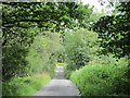
9
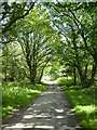
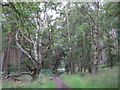
Road to Viewley Farm
On the edge of Slaley Forest.
Image: © Oliver Dixon
Taken: 29 Jul 2017
0.16 miles