
IMAGES TAKEN NEAR TO
Gloucester Terrace, NEWCASTLE UPON TYNE, NE4 6RH
Introduction
This page details the photographs taken nearby to Gloucester Terrace, NE4 6RH by members of the Geograph project.
The Geograph project started in 2005 with the aim of publishing, organising and preserving representative images for every square kilometre of Great Britain, Ireland and the Isle of Man.

There are currently over 7.5m images from over14,400 individuals and you can help contribute to the project by visiting https://www.geograph.org.uk
Image Map
Images are licensed for reuse under creativecommons.org/licenses/by-sa/2.0
Notes
- Clicking on the map will re-center to the selected point.
- The higher the marker number, the further away the image location is from the centre of the postcode.
Image Listing (62 Images Found)
Images are licensed for reuse under creativecommons.org/licenses/by-sa/2.0
Image
Details
Distance
1
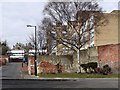
Back lane between Ashfield Close and Hawthorn Terrace
The upper part of Image can be seen above low buildings at the top the lane.
Image: © Andrew Curtis
Taken: 11 Mar 2010
0.06 miles
2
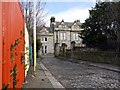
Elswick Lodge, Park Close
Villa, built in 1844 for Robert Hawthorn, locomotive manufacturer http://en.wikipedia.org/wiki/R_and_W_Hawthorn
From 1920 to 1969 it was run by Newcastle Diocesan Council for Moral Welfare as a mother's and babies home. It is now a rehabilitation centre.
Tyne and Wear HER (8753): Elswick, Park Close, Elswick Lodge and wall attached http://www.twsitelines.info
Image: © Andrew Curtis
Taken: 11 Mar 2010
0.07 miles
3

Path across green in Elswick
From Elswick Road.
Image: © Stephen Sweeney
Taken: 12 Jan 2009
0.10 miles
4
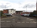
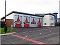
The rear of Newcastle Central Fire Station
Looking at the car park and rear part of the building of Newcastle Central Fire Station.
Image: © Graham Robson
Taken: 6 Dec 2017
0.12 miles
5
Looking to Todd's Nook high flats from Elswick Road
Image: © Stephen Sweeney
Taken: 12 Jan 2009
0.13 miles
6
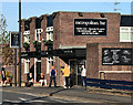
Metropolitan Bar
The Metropolitan Bar on Westmorland Road.
Image: © Peter McDermott
Taken: 1 May 2011
0.14 miles
7
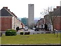
Kenilworth Road, Elswick
View down the terraced street towards Cruddas Park House.
Image: © Andrew Curtis
Taken: 11 Mar 2010
0.15 miles
8
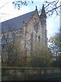
Former St. Paul's Church, Elswick
The church was at the foot of Cromwell Street
Image: © Anthony Foster
Taken: 25 Nov 2006
0.15 miles
10
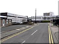
Waverley Road
View of the Mather and Waverley Road flats complex Image
Image: © Andrew Curtis
Taken: 11 Mar 2010
0.16 miles