
IMAGES TAKEN NEAR TO
Mill Farm Close, NEWCASTLE UPON TYNE, NE4 6NF
Introduction
This page details the photographs taken nearby to Mill Farm Close, NE4 6NF by members of the Geograph project.
The Geograph project started in 2005 with the aim of publishing, organising and preserving representative images for every square kilometre of Great Britain, Ireland and the Isle of Man.

There are currently over 7.5m images from over14,400 individuals and you can help contribute to the project by visiting https://www.geograph.org.uk
Image Map
Images are licensed for reuse under creativecommons.org/licenses/by-sa/2.0
Notes
- Clicking on the map will re-center to the selected point.
- The higher the marker number, the further away the image location is from the centre of the postcode.
Image Listing (284 Images Found)
Images are licensed for reuse under creativecommons.org/licenses/by-sa/2.0
Image
Details
Distance
1
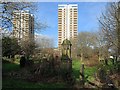
Westgate Hill Cemetery
View towards the flats on Westgate Road: Vallum Court (left) and Westgate Court (centre). The third block of flats off screen to the right is Todd's Nook.
Image: © Andrew Curtis
Taken: 27 Jan 2016
0.01 miles
2
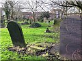
Westgate Hill Cemetery
View towards houses on Elswick Row.
Image: © Andrew Curtis
Taken: 27 Jan 2016
0.03 miles
3

Westgate Hill Cemetery (2)
Shows the location of Image
Image: © Mike Quinn
Taken: 5 May 2016
0.03 miles
4
Westgate Hill Cemetery
Shows the location of Image
Image: © Mike Quinn
Taken: 5 May 2016
0.03 miles
5
Gravestones in cemetery at Big Lamp
Looking in off Westgate Road.
Image: © Stephen Sweeney
Taken: 12 Jan 2009
0.04 miles
6
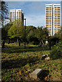
Westgate Hill General Cemetery
Westgate Hill General Cemetery is a sadly neglected graveyard. No longer in use for burials, it's reportedly known as a location of anti-social behaviour. The tower blocks beyond are two of three buildings well known on Tyneside and visible for miles around.
Image: © Trevor Littlewood
Taken: 21 Oct 2010
0.04 miles
7
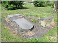
Clennell Family tomb in Westgate Hill Cemetery
The tomb is Grade II listed https://www.historicengland.org.uk/listing/the-list/list-entry/1338567 . For the obvious reason, I cannot be absolutely certain that this is the tomb - but it fits the description in the text of the listing "Headstone. Circa 1854. Signed Pearson of Gibson Street. Sandstone ashlar. Round-topped moulded slab commemorating John and Elizabeth Clennell of St. Peter's Quay died 1854 and 56, their son Luke and members of the Clennell family to 1938"; and the location was that given in the listing. Luke Clennell was one of the best of a vigorous school of Newcastle painters https://en.wikipedia.org/wiki/Luke_Clennell .
Image: © Mike Quinn
Taken: 5 May 2016
0.04 miles
8

Benchmark on gatepost at Westgate Road entrance to cemetery
Ordnance Survey cut mark benchmark described on the Bench Mark Database at http://www.bench-marks.org.uk/bm43172
Image: © Roger Templeman
Taken: 21 May 2012
0.04 miles
9
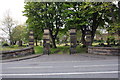
Entrance to Westgate Hill cemetery from Westgate Road
There is an OS benchmark Image on the right hand gatepost
Image: © Roger Templeman
Taken: 21 May 2012
0.04 miles
10
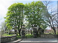
Gate piers, walls and piers to Westgate Hill Cemetery
The piers and walls are Grade II listed https://www.historicengland.org.uk/listing/the-list/list-entry/1024742 . The text of the listing includes "1825-29 by John Green: Sandstone ashlar. 4 tall gate piers, the central pair higher, forming carriage and pedestrian entrances. Each has plinth, banded cornice and top pedestal".
Image: © Mike Quinn
Taken: 5 May 2016
0.04 miles