IMAGES TAKEN NEAR TO
HEXHAM, NE46 2JY
Introduction
This page details the photographs taken nearby to NE46 2JY by members of the Geograph project.
The Geograph project started in 2005 with the aim of publishing, organising and preserving representative images for every square kilometre of Great Britain, Ireland and the Isle of Man.

There are currently over 7.5m images from over14,400 individuals and you can help contribute to the project by visiting https://www.geograph.org.uk
Image Map
Images are licensed for reuse under creativecommons.org/licenses/by-sa/2.0
Notes
- Clicking on the map will re-center to the selected point.
- The higher the marker number, the further away the image location is from the centre of the postcode.
Image Listing (10 Images Found)
Images are licensed for reuse under creativecommons.org/licenses/by-sa/2.0
Image
Details
Distance
3
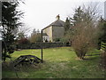
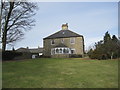
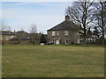
Medieval Well in the grounds of Dotland Farm
Image: © Les Hull
Taken: 3 Mar 2010
0.02 miles
5
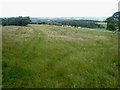
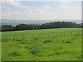
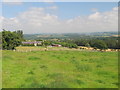
Medieval village at Dotland
This rather unprepossessing field of humps and hollows marks this site of what was in Mediaeval times a substantial village http://www.durham-pa.gov.uk/durhamcc/K2P.nsf/K2PDetail?readform&PRN=N8336. The hills on the skyline lie to the north of the Tyne valley.
Image: © Oliver Dixon
Taken: 8 Jul 2008
0.09 miles
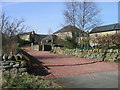
7
Site of the mediaeval village at Dotland
Image: © Mike Quinn
Taken: 27 Jul 2011
0.14 miles
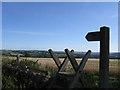
8
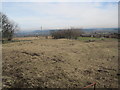
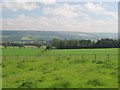
Dotland Shrunken Medieval Village
There has been a settlement at Dotland since at least the 13th century when it was recorded as a grange in 1287. At this time it belonged to the Priory of Hexham. In the 14th century it had become a tenanted farm and in 1379 a number of people are recorded living there. The population of the village seems to have fallen quite drastically by this time but over the next 400 years it grew again until there was a substantial settlement here by 1769. However, today there are only two farms and a few cottages. The earlier settlement has left its mark in the clear earthworks marking former house and garden plots. There are also remains of the medieval field system with ridge and furrow earthworks nearby.
http://www.keystothepast.info/durhamcc/K2P.nsf/K2PDetail?readform&PRN=N8336
Image: © Les Hull
Taken: 3 Mar 2010
0.14 miles