
IMAGES TAKEN NEAR TO
Bath Lane, NEWCASTLE UPON TYNE, NE4 5SP
Introduction
This page details the photographs taken nearby to Bath Lane, NE4 5SP by members of the Geograph project.
The Geograph project started in 2005 with the aim of publishing, organising and preserving representative images for every square kilometre of Great Britain, Ireland and the Isle of Man.

There are currently over 7.5m images from over14,400 individuals and you can help contribute to the project by visiting https://www.geograph.org.uk
Image Map
Images are licensed for reuse under creativecommons.org/licenses/by-sa/2.0
Notes
- Clicking on the map will re-center to the selected point.
- The higher the marker number, the further away the image location is from the centre of the postcode.
Image Listing (1406 Images Found)
Images are licensed for reuse under creativecommons.org/licenses/by-sa/2.0
Image
Details
Distance
1

West Walls, Newcastle (1)
Along Bath Lane.
Image: © Richard Vince
Taken: 30 Jun 2018
0.02 miles
2
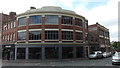
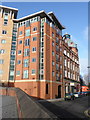
Corner of Bath Lane and Rutherford Street
Newcastle Furniture Company occupies the building in the foreground.
On the right are the derelict premises once occupied by Henry Moat and Son. In 2018 that building will be demolished to make way for a 36 storey tower block to be known as Hadrian's Tower.
Image: © Anthony Foster
Taken: 16 Jul 2017
0.02 miles
4
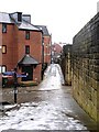
West Walls, near Stowell Street
A view from below the Durham Tower looking up this lane is here Image
Image: © Andrew Curtis
Taken: 15 Jan 2010
0.02 miles
5
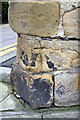
Benchmark on the town wall near Blackfriars Court
Ordnance Survey cut mark benchmark described on the Bench Mark Database at http://www.bench-marks.org.uk/bm32851
Image: © Roger Templeman
Taken: 21 May 2012
0.02 miles
6
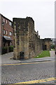
End of the town wall beside Stowell Street
There is an OS benchmark Image at the left hand side of the wall end
Image: © Roger Templeman
Taken: 21 May 2012
0.02 miles
9
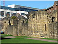
Town Walls (by Bath Lane, NE1)
Photo shows the stretch of late 13th C Town Wall between Westgate Road and Image The original wall was 20ft high, and it is not far short of its full height here. Just to the right of centre is Durham Tower, one of the least altered and best preserved. There is a continuous lane inside the walls - see Image This part of the wall is Grade I listed http://list.historicengland.org.uk/resultsingle.aspx?uid=1186222 .
The Buildings of Grainger Town - No.175. See Image
The Buildings of Grainger Town - No.175. See Image
Image: © Mike Quinn
Taken: 29 Oct 2013
0.03 miles
10
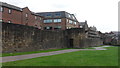
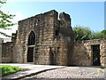
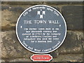
Newcastle Town Wall: West Walls and Durham Tower
Dating from the late 13th century, the wall is listed, Grade I and is a Scheduled Ancient Monument. This section on Bath Lane was opened up following slum clearance in the 1960s.
Image: © Anthony Foster
Taken: 16 Jul 2017
0.03 miles