
Town Walls (by Bath Lane, NE1)
Introduction
The photograph on this page of Town Walls (by Bath Lane, NE1) by Mike Quinn as part of the Geograph project.
The Geograph project started in 2005 with the aim of publishing, organising and preserving representative images for every square kilometre of Great Britain, Ireland and the Isle of Man.

There are currently over 7.5m images from over 14,400 individuals and you can help contribute to the project by visiting https://www.geograph.org.uk
Town Walls (by Bath Lane, NE1)
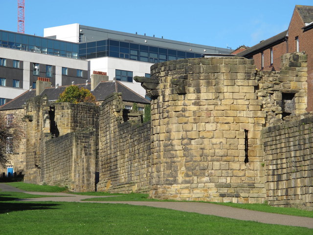
Image: © Mike Quinn Taken: 29 Oct 2013
Photo shows the stretch of late 13th C Town Wall between Westgate Road and Image The original wall was 20ft high, and it is not far short of its full height here. Just to the right of centre is Durham Tower, one of the least altered and best preserved. There is a continuous lane inside the walls - see Image This part of the wall is Grade I listed http://list.historicengland.org.uk/resultsingle.aspx?uid=1186222 . The Buildings of Grainger Town - No.175. See Image The Buildings of Grainger Town - No.175. See Image
Images are licensed for reuse under creativecommons.org/licenses/by-sa/2.0
Image Location

Latitude
54.971107
Longitude
-1.620847