
IMAGES TAKEN NEAR TO
Parson Road, WYLAM, NE41 8EQ
Introduction
This page details the photographs taken nearby to Parson Road, NE41 8EQ by members of the Geograph project.
The Geograph project started in 2005 with the aim of publishing, organising and preserving representative images for every square kilometre of Great Britain, Ireland and the Isle of Man.

There are currently over 7.5m images from over14,400 individuals and you can help contribute to the project by visiting https://www.geograph.org.uk
Image Map
Images are licensed for reuse under creativecommons.org/licenses/by-sa/2.0
Notes
- Clicking on the map will re-center to the selected point.
- The higher the marker number, the further away the image location is from the centre of the postcode.
Image Listing (112 Images Found)
Images are licensed for reuse under creativecommons.org/licenses/by-sa/2.0
Image
Details
Distance
3
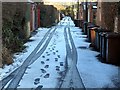
Back lane, Wylam
Two sets of prints in early morning snow. Are both connected?
Image: © Andrew Curtis
Taken: 13 Jan 2017
0.09 miles
4
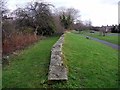
Site of the former North Wylam Railway Station
There is another photo here Image
North Wylam was the most westerly station on the Scotswood, Newburn & Wylam Railway. It was opened in 1876 and closed in 1968. The site was cleared in January 1975 leaving few visible remains. It is now a grassy open space adjacent to the car park of the Tyne Riverside Park and the former track ('Wylam Waggonway') a walking and cycle route.
There is a detailed account here: http://www.disused-stations.org.uk/n/north_wylam/index.shtml
Image: © Andrew Curtis
Taken: 25 Dec 2011
0.11 miles
5
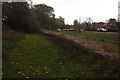
North Wylam railway station
This platform edge is all that remains of the station on a railway that started as a wagonway running past the nearby birthplace of George Stephenson Image
Image: © Graham Hogg
Taken: 16 May 2013
0.11 miles
6
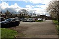
Car park, Wylam
A car park in the centre of Wylam village.
Image: © Graham Robson
Taken: 22 Apr 2018
0.11 miles
7
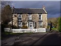
Former 'Stephenson's Arms', Wylam
Old maps from 1897 show that this house was formerly the Stephenson's Arms public house. Its location is just east of the former North Wylam Railway Station.
Image: © Andrew Curtis
Taken: 25 Dec 2011
0.11 miles
8
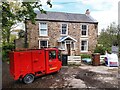
Stephenson's Arms & Minghong Cargo Tricycle, Wylam
The house is described here: Image
Image: © Andrew Curtis
Taken: 7 May 2023
0.11 miles
9
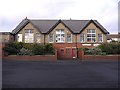
Wylam Library, Falcon Terrace
Also known as the Falcon Centre. Wylam Railway Museum was opened in part of this former school building in 1981, the bicentenary of the birth of George Stephenson, to commemorate Wylam’s unique contribution to railway history. There are displays on the famous local railway pioneers, George Stephenson ('the Father of the Railways'), William Hedley (manager of the Wylam Colliery and designer of the historic locomotives, Puffing Billy and Wylam Dilly), Timothy Hackworth (colliery blacksmith) and Nicholas Wood (colliery and early railway engineer).
WHERE RAILWAYS WERE BORN: The Story of Wylam and its railway pioneers by Philip R.B.Brooks http://www.tynedaleheritage.org/PdfWordDocs/WhereRailwaysWereBorn.PDF
Image: © Andrew Curtis
Taken: 25 Dec 2011
0.12 miles
10
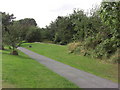
Former North Wylam Railway Station
The stones in the centre of the photo are the remains of the eastbound platform. More info at http://www.subbrit.org.uk/sb-sites/stations/n/north_wylam/index.shtml. The station is now part of the Tyne Riverside Country Park and Hadrian's Way National Cycle Route.
Image: © Anthony Foster
Taken: 31 Aug 2009
0.12 miles