IMAGES TAKEN NEAR TO
Garden House Estate, RYTON, NE40 4PU
Introduction
This page details the photographs taken nearby to Garden House Estate, NE40 4PU by members of the Geograph project.
The Geograph project started in 2005 with the aim of publishing, organising and preserving representative images for every square kilometre of Great Britain, Ireland and the Isle of Man.

There are currently over 7.5m images from over14,400 individuals and you can help contribute to the project by visiting https://www.geograph.org.uk
Image Map
Images are licensed for reuse under creativecommons.org/licenses/by-sa/2.0
Notes
- Clicking on the map will re-center to the selected point.
- The higher the marker number, the further away the image location is from the centre of the postcode.
Image Listing (7 Images Found)
Images are licensed for reuse under creativecommons.org/licenses/by-sa/2.0
Image
Details
Distance
2
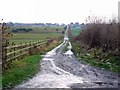
Footpath to Bar Moor
Bar Moor is an old settlement between Crawcrook and Ryton. Although the track is quite straight, old maps show no sign of its previous existence as a waggonway. It does however have a long history as a footpath and as an access track to Hareshaw Quarry, located in the left side fields.
Image: © Andrew Curtis
Taken: 30 Dec 2010
0.23 miles
4
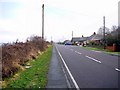
Stannerford Road, Crawcrook
An access road only to the isolated village of Clara Vale from the through road from Wylam to Crawcrook. The name of the road comes from Stanner Ford an old route across the River Tyne near to Clara Vale. The 1:10560 OS Map from 1860 gives the approximate location of the ford as Image
'Stanners' is the local Geordie dialect name for parts of rivers covered by deposits of stones and gravel, often allowing people and animals to wade across (at least at low water) http://www.hawaii.edu/satocenter/langnet/definitions/geordie.html
The name is used in this way on the Tyne at Ryton (Doctor's Stanners), Corbridge and Newburn, and on other rivers in Warkworth and near Morpeth.
Image: © Andrew Curtis
Taken: 30 Dec 2010
0.24 miles
5
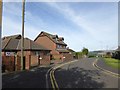
Kestrel Close, Crawcrook
Typo in the street sign which reads "Kestel Close".
Image: © Oliver Dixon
Taken: 23 Sep 2016
0.24 miles
6
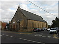
The Ark, Crawcrook
Replacing Image as a church, a soft play centre and a cafe.
Image: © Anthony Foster
Taken: 23 Sep 2016
0.24 miles