IMAGES TAKEN NEAR TO
Greenfield Place, RYTON, NE40 3LY
Introduction
This page details the photographs taken nearby to Greenfield Place, NE40 3LY by members of the Geograph project.
The Geograph project started in 2005 with the aim of publishing, organising and preserving representative images for every square kilometre of Great Britain, Ireland and the Isle of Man.

There are currently over 7.5m images from over14,400 individuals and you can help contribute to the project by visiting https://www.geograph.org.uk
Image Map (Loading...)


Getting Data...Please wait
Leaflet Map data © OpenStreetMap
Images are licensed for reuse under creativecommons.org/licenses/by-sa/2.0
Notes
- Clicking on the map will re-center to the selected point.
- The higher the marker number, the further away the image location is from the centre of the postcode.
Image Listing (9 Images Found)
Images are licensed for reuse under creativecommons.org/licenses/by-sa/2.0
Image
Details
Distance
2
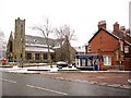
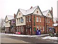
Lane Head, Ryton
In the distance is Ryton Methodist Church.
Image: © Anthony Foster
Taken: 1 Jan 2018
0.08 miles
6
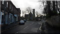
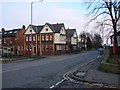
May Avenue, Ryton
View from Northumberland Road.
Image: © Andrew Curtis
Taken: 7 Jan 2011
0.22 miles
7
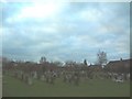
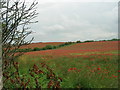
Ryton Cemetery
View looking south. The houses on the right are on Grange Drive.
Image: © Steve McShane
Taken: 28 Jan 2006
0.23 miles
8
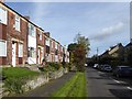
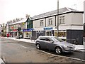
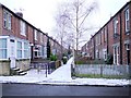
Terraced houses on Whitewell Lane, Ryton
Image: © Oliver Dixon
Taken: 23 Sep 2016
0.24 miles