IMAGES TAKEN NEAR TO
Rushton Way, WASHINGTON, NE38 8FF
Introduction
This page details the photographs taken nearby to Rushton Way, NE38 8FF by members of the Geograph project.
The Geograph project started in 2005 with the aim of publishing, organising and preserving representative images for every square kilometre of Great Britain, Ireland and the Isle of Man.

There are currently over 7.5m images from over14,400 individuals and you can help contribute to the project by visiting https://www.geograph.org.uk
Image Map
Images are licensed for reuse under creativecommons.org/licenses/by-sa/2.0
Notes
- Clicking on the map will re-center to the selected point.
- The higher the marker number, the further away the image location is from the centre of the postcode.
Image Listing (48 Images Found)
Images are licensed for reuse under creativecommons.org/licenses/by-sa/2.0
Image
Details
Distance
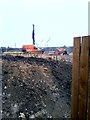
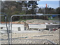
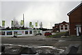
3
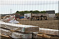
House building
Teal farm Village
Image: © gordon james brown
Taken: 27 May 2013
0.06 miles
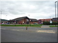
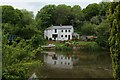
6
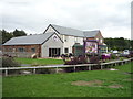
The Teal Farm public house, Washington
On Edale Close.
Image: © JThomas
Taken: 18 Aug 2018
0.11 miles
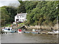
9
The famous Gassy Gutter , river Wear
Image: © gordon james brown
Taken: 30 Sep 2012
0.14 miles
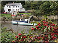
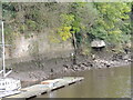
10
Barmston Ferry
A rowing boat used to cross the River Wear at this point, until the footbridge was opened in 1958.
The scene photographed on the Weardale Way in Cox Green, upon the opposite bank.
Image: © Chris Heaton
Taken: 18 May 2023
0.15 miles