IMAGES TAKEN NEAR TO
Waterloo Square, SOUTH SHIELDS, NE33 1AX
Introduction
This page details the photographs taken nearby to Waterloo Square, NE33 1AX by members of the Geograph project.
The Geograph project started in 2005 with the aim of publishing, organising and preserving representative images for every square kilometre of Great Britain, Ireland and the Isle of Man.

There are currently over 7.5m images from over14,400 individuals and you can help contribute to the project by visiting https://www.geograph.org.uk
Image Map (123 Images)


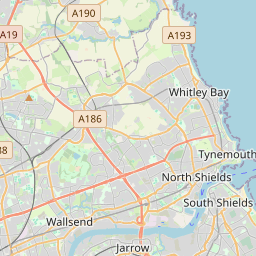
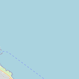
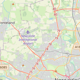


Leaflet Map data © OpenStreetMap
Images are licensed for reuse under creativecommons.org/licenses/by-sa/2.0
Notes
- Clicking on the map will re-center to the selected point.
- The higher the marker number, the further away the image location is from the centre of the postcode.
Image Listing (123 Images Found)
Images are licensed for reuse under creativecommons.org/licenses/by-sa/2.0
Image
Details
Distance
1
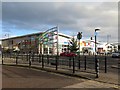
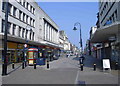
Shopping Centre, Keppel Street, South Shields
Image: © Andrew Curtis
Taken: 27 Nov 2015
0.02 miles
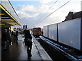
2
Waterloo Square, South Shields
New retail units very near to the town centre.
Image: © Bill Boaden
Taken: 18 Sep 2011
0.02 miles
3
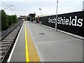
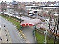
South Shields Metro station, Tyne & Wear
Opened in 2019 by the Tyne & Wear Metro as the terminus of the line from Pelaw and Newcastle, this station with bus interchange replaced a 1984 Metro station in the distance.
View north towards the end of the line.
Image: © Nigel Thompson
Taken: 28 Aug 2019
0.04 miles
4
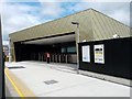
Metro Platform - Transport Interchange, South Shields
The £21m bus and Metro interchange opened to passengers on the 4th of August 2019. It is located about 100 metres from the old Metro Station. The old Metro station on King Street closed on the 8th of July 2019, in preparation for the opening of this new Transport Interchange which brought the Metro and bus services together under one roof. The old Metro station opened in 1984 and was the first station on the Tyne and Wear Metro to be permanently closed. In its 35 years of service the station had been used by over 50 million passengers, including tens of thousands or Great North Run athletes and spectators. The station had also featured in a song by pop group Franz Ferdinand. See: https://co-curate.ncl.ac.uk/south-shields-metro-station/
Image: © Simon Cotterill
Taken: 15 Aug 2019
0.04 miles
5
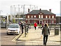
Building on Barrington Street & gasometer
The gas holder was installed in Oyston Street off Garden Lane in the early 1900s and dominated Waterloo Vale. Much of the former gasworks site is now a supermarket carpark. The structure was overhauled and repainted in 2009.
It was reported in February 2015 that the imposing gasometer, situated in Garden Lane, South Shields, which has dominated the town centre skyline for decades, is to be torn down by owners, Northern Gas Networks, probably by 2018.
A company spokesman said, “There is no longer any use for gas holders.”
It is one of hundreds of similar structures being wiped off the map ever since natural gas was discovered in the North Sea in 1965. Gas holders once stored coal gas, and later natural gas, for the UK’s urban areas, but now all but a handful are obsolete. The UK gas network went through a major process of conversion, with town gas no longer used, and North Sea gas being transported into the UK under high pressure in pipes. From this point, it was only when extra capacity was needed in the gas network that gas holders would be used. As the network of pipelines became larger and more effective, these occasions became fewer, with gas holders becoming a sizeable industrial relic of the past.
http://www.shieldsgazette.com/news/community/landmark-or-eyesore-south-shields-gasometer-to-be-demolished-1-7082274
These structures are far from being universally hated. They have Industrial Archaeology interest and an artistic sculptural quality.
http://www.shieldsgazette.com/time-of-our-lives/some-still-find-beauty-in-our-disappearing-industries-1-7086467
Image: © Andrew Curtis
Taken: 27 Nov 2015
0.04 miles
6
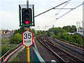
The view west from South Shields Metro Station
The dual track railway converges into a single track as it enters the station.
Image: © John Lucas
Taken: 15 Aug 2016
0.06 miles
8
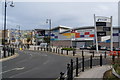
South Shields Bus Station
Located in Keppel Street. Seen from the Metro Station.
Image: © Oliver Dixon
Taken: 29 Feb 2016
0.07 miles
9
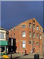
Converted warehouse, East Street, South Shields
Image: © Andrew Curtis
Taken: 27 Nov 2015
0.07 miles