IMAGES TAKEN NEAR TO
NE32 9BJ
Introduction
This page details the photographs taken nearby to NE32 9BJ by members of the Geograph project.
The Geograph project started in 2005 with the aim of publishing, organising and preserving representative images for every square kilometre of Great Britain, Ireland and the Isle of Man.

There are currently over 7.5m images from over14,400 individuals and you can help contribute to the project by visiting https://www.geograph.org.uk
Image Map
Images are licensed for reuse under creativecommons.org/licenses/by-sa/2.0
Notes
- Clicking on the map will re-center to the selected point.
- The higher the marker number, the further away the image location is from the centre of the postcode.
Image Listing (164 Images Found)
Images are licensed for reuse under creativecommons.org/licenses/by-sa/2.0
Image
Details
Distance
1
Burns Street in Jarrow
Burns Street in Jarrow looking towards Grange Road
To the right of the picture is the wall of the Millennium PHAB Club
Which was formerly the site of the Regal Cinema
And the Kino Cinema before that
Image: © Vin Mullen
Taken: 16 Feb 2007
0.02 miles
2
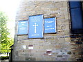
Jarrow National Spiritualist Church
Jarrow National Spiritualist Church in Cambrian Street Jarrow
Image: © Vin Mullen
Taken: 12 Jul 2009
0.04 miles
3
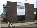
Millennium Phab Club in Jarrow
Millennium Phab Club (Physically Handicapped and Able Bodied) in Grange Road in Jarrow
Image: © Vin Mullen
Taken: 27 Nov 2009
0.04 miles
4
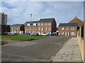
Grange Road, Jarrow
Grange Road in Jarrow. Despite being residential, this road is more-or-less in the centre of the town.
Image: © Malc McDonald
Taken: 20 Sep 2019
0.04 miles
6
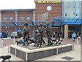
Jarrow: the Spirit of Jarrow
This bronze was unveiled in 2001 in the shopping centre car park, outside Morrison's supermarket entrance. See http://news.bbc.co.uk/1/hi/england/1581572.stm
Image: © Chris Downer
Taken: 24 Oct 2007
0.04 miles
7
Cambrian Street in Jarrow
Cambrian Street in Jarrow taken from Morrison's car park.
To the left on the picture is the Postal sorting office.
In the centre of the picture is the Library.
Behind that is Monastery Court highrise flats.
And to the far right of the picture is Jarrow Community Centre
Image: © Vin Mullen
Taken: 24 May 2009
0.04 miles
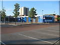
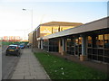
8
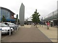
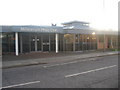
Outside the Viking Shopping Centre, Jarrow
The public space outside one of the entrances to the Viking Shopping Centre in Jarrow town centre. A Morrisions supermarket attached to the centre is just visible on the left.
Image: © Graham Robson
Taken: 7 Oct 2017
0.05 miles
9
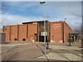
Jarrow Community Centre
Jarrow Community Centre in Cambrian Street Jarrow
Image: © Vin Mullen
Taken: 16 Feb 2007
0.05 miles
10
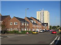
Grange Road in Jarrow
Grange Road in Jarrow.
Looking East.
On the left of the picture the New Tyne Crossing construction.
The furthest building is the Royal Oak Public House (Longbar).
Then the Mid Tyne Activities Centre.
And finally on the right of the picture the Millennium PHAB Club.
Image: © Vin Mullen
Taken: 27 Nov 2009
0.06 miles