
IMAGES TAKEN NEAR TO
Milldene Avenue, NORTH SHIELDS, NE30 2PS
Introduction
This page details the photographs taken nearby to Milldene Avenue, NE30 2PS by members of the Geograph project.
The Geograph project started in 2005 with the aim of publishing, organising and preserving representative images for every square kilometre of Great Britain, Ireland and the Isle of Man.

There are currently over 7.5m images from over14,400 individuals and you can help contribute to the project by visiting https://www.geograph.org.uk
Image Map
Images are licensed for reuse under creativecommons.org/licenses/by-sa/2.0
Notes
- Clicking on the map will re-center to the selected point.
- The higher the marker number, the further away the image location is from the centre of the postcode.
Image Listing (15 Images Found)
Images are licensed for reuse under creativecommons.org/licenses/by-sa/2.0
Image
Details
Distance
1
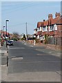
Millview Drive, Tynemouth
This quiet street has been designated as part of an advisory cycle route running south-north from Tynemouth to Whitley Bay.
Image: © Oliver Dixon
Taken: 28 Mar 2012
0.06 miles
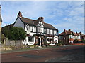
3
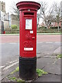
Post Box, The Broadway, Tynemouth
This post box, which stands at the junction with Kennersdene, dates from the reign of King George V (1910-1936). The Royal Mail is a key partner in the Government's Coronavirus testing programme and collect completed testing kits from over 35,000 specially selected post boxes of which this is one (see stickers attached to the box). For a selection of detailed free to download walking routes in the area visit www.northtynesidewalks.co.uk
Image: © Geoff Holland
Taken: 2 Mar 2021
0.14 miles
4
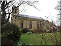
Church of Holy Saviour, Cross Way, Tynemouth
Built between 1839 and 1841 by well-known architects John and Benjamin Green for the Duke of Northumberland, this is a Grade II Listed building. For a selection of detailed free to download walking routes in the area visit www.northtynesidewalks.co.uk
Image: © Geoff Holland
Taken: 2 Mar 2021
0.15 miles
5
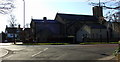
Holy Saviours Church, Tynemouth
The church was built in 1839 on a site donated by the Duke of Northumberland who also donated £200 towards the building costs
Image: © Christine Westerback
Taken: 19 Feb 2012
0.15 miles
6
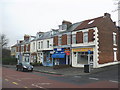
Row of shops, in King Edward Road, Tynemouth
Image: © Roger Cornfoot
Taken: 7 Feb 2010
0.16 miles
7

NEW
Norah Balls blue plaque, Tynemouth
Outside the former home on King Edward Road, of the high-profile activist who fought alongside Emmeline Pankhurst to secure the vote for women. She went on to become a magistrate - despite once appearing in the dock herself - a councillor, and helped set up the Girl Guides in Northumberland. The plaque was unveiled on International Women's Day in 2022.
Image: © Paul Harrop
Taken: 16 Sep 2026
0.17 miles
8
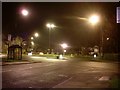
Roundabout in Tynemouth
Near the Metro station, at the crossing of Manor Road and Broadway.
Image: © Stephen Sweeney
Taken: 14 Jan 2009
0.18 miles
9
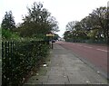
King Edward Road in Tynemouth
On the border with North Shields. The road is along the north side of Northumberland Park.
Image: © Robert Graham
Taken: 14 Nov 2022
0.18 miles
10
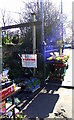
Market Garden
On the corner of Manor Road and Percy Park, Tynemouth
Image: © Christine Westerback
Taken: 19 Feb 2012
0.19 miles