
IMAGES TAKEN NEAR TO
Laurel Court, NORTH SHIELDS, NE30 1PG
Introduction
This page details the photographs taken nearby to Laurel Court, NE30 1PG by members of the Geograph project.
The Geograph project started in 2005 with the aim of publishing, organising and preserving representative images for every square kilometre of Great Britain, Ireland and the Isle of Man.

There are currently over 7.5m images from over14,400 individuals and you can help contribute to the project by visiting https://www.geograph.org.uk
Image Map
Images are licensed for reuse under creativecommons.org/licenses/by-sa/2.0
Notes
- Clicking on the map will re-center to the selected point.
- The higher the marker number, the further away the image location is from the centre of the postcode.
Image Listing (188 Images Found)
Images are licensed for reuse under creativecommons.org/licenses/by-sa/2.0
Image
Details
Distance

2
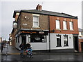
The Alnwick Castle, Saville Row, North Shields
Image: © Roger Cornfoot
Taken: 12 Feb 2010
0.03 miles
3

Mural (In progress), Norfolk Street, North Shields
This large gable end mural, work on which had just recently started when this photograph was taken, forms part of the North Shields 'Elevation Mural Festival' which intends to transform the town into a vibrant open-air art gallery. The artist is Rotterdam-based Nina Valkhoff, a muralist who has been painting murals for over 23 years which generally "highlight flora and fauna, often featuring unknown or underappreciated animals". The mural faces up Norfolk Street and will be highly visible by motorists driving down this one-way street.
Image: © Geoff Holland
Taken: 8 Jul 2025
0.03 miles
4

'The Chase' Mural, Norfolk Street, North Shields
Seen as a work in progress at https://www.geograph.org.uk/photo/8091629, this is the completed work. Created by Rotterdam-based Nina Valkhoff, a muralist who has been painting murals for over 23 years, the mural forms part of the North Shields 'Elevation Mural Festival' which intends to transform the town into a vibrant open-air art gallery. The year 2025 is the 800th anniversary of the town.
Image: © Geoff Holland
Taken: 15 Jul 2025
0.03 miles
5
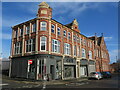
The Wooden Deli, Saville Street, North Shields
This building stands on the corner of Saville Street and Norfolk Street with the former General Post Office at the far end of the block. For a selection of detailed free to download walking routes in the area visit www.northtynesidewalks.co.uk
Image: © Geoff Holland
Taken: 16 Feb 2021
0.04 miles
6
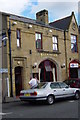
Bell & Bucket
Could this once have been part of the fire station?
Image: © Mac McCarron
Taken: 25 Sep 2007
0.04 miles
7

Former Free Methodist chapel, Howard Street, North Shields
Now used as Borough offices, the Chapel on the east side of Howard Street was built in 1856-57 by Green for United Free Methodists. The Free Methodist Church was formed in North Shields in 1850 by the Wesleyan Association, the Protestant Methodists and the Armenian Methodists.
Pastscape: http://www.pastscape.org.uk/hob.aspx?hob_id=1504371 https://web.archive.org/web/20170221190131/https://www.pastscape.org.uk/hob.aspx?hob_id=1504371
The building to its right housed the Town Improvement Commissioner's Offices, Savings Bank, Mechanics Institute, Museum and Police Station. It was built 1844-5 by John Dobson for North Shields Improvement Commissioners and taken over as Town Hall 1849.
Historic England: https://historicengland.org.uk/listing/the-list/list-entry/1354989 https://web.archive.org/web/20200627203956/https://historicengland.org.uk/listing/the-list/list-entry/1354989
The junction with Saville Street is just beyond.
Image: © Andrew Curtis
Taken: 28 Jul 2013
0.06 miles
8

Former Town Hall, Howard Street, North Shields
The extensive former Town Hall, which was built between 1844-45 to a John Dobson design, is a Grade II Listed building and was considered to be a landmark building by North Tyneside Council in their 2014 'Northumberland Square Conservation Area Character Appraisal'. Originally designed to hold the Town Improvement Commission Offices, Savings Bank, Mechanics' Institute, Museum and Police Station, it became the Town Hall in 1849. For a selection of detailed free to download walking routes in the area visit www.northtynesidewalks.co.uk
Image: © Geoff Holland
Taken: 16 Feb 2021
0.06 miles
10
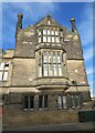
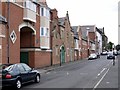
Part of the Former Town Hall, Saville Street, North Shields
The extensive former Town Hall, which was built between 1844-45 to a John Dobson design, is a Grade II Listed building and was considered to be a landmark building by North Tyneside Council in their 2014 'Northumberland Square Conservation Area Character Appraisal'. Originally designed to hold the Town Improvement Commission Offices, Savings Bank, Mechanics' Institute, Museum and Police Station, it became the Town Hall in 1849. This section of the building stands on the corner of Saville Street and Norfolk Street and has two very fine oriel bay windows. For a selection of detailed free to
download walking routes in the area visit www.northtynesidewalks.co.uk
Image: © Geoff Holland
Taken: 16 Feb 2021
0.06 miles