
IMAGES TAKEN NEAR TO
Upper Penman Street, NORTH SHIELDS, NE29 6SR
Introduction
This page details the photographs taken nearby to Upper Penman Street, NE29 6SR by members of the Geograph project.
The Geograph project started in 2005 with the aim of publishing, organising and preserving representative images for every square kilometre of Great Britain, Ireland and the Isle of Man.

There are currently over 7.5m images from over14,400 individuals and you can help contribute to the project by visiting https://www.geograph.org.uk
Image Map
Images are licensed for reuse under creativecommons.org/licenses/by-sa/2.0
Notes
- Clicking on the map will re-center to the selected point.
- The higher the marker number, the further away the image location is from the centre of the postcode.
Image Listing (9 Images Found)
Images are licensed for reuse under creativecommons.org/licenses/by-sa/2.0
Image
Details
Distance
1
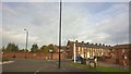
Howdon Road, from Dock Road, North Shields
Image: © Chris Morgan
Taken: 30 Oct 2016
0.06 miles
2
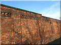
Brick Wall, Minton Lane
This fine brick wall, which stretches for more than 200 metres on the north side of Minton Lane, was once the southern boundary wall of the Minton Lane Gas Works. First appearing on the second edition of the Ordnance Survey Six-Inch map of the area in 1899, the gas works were, until dismantled in 2016, a vital part of the gas supply system, responsible for supplying gas to thousands of people across the country. More latterly, they were used to bolster the gas network’s supplies during colder weather, and at peak times in the early evenings. At the time of the publication of the 1899 map Minton Lane was known as Meadowell Lane. For a selection of detailed free to download walking routes in the area visit www.northtynesidewalks.co.uk
Image: © Geoff Holland
Taken: 30 Oct 2020
0.08 miles
5
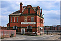
Wolsington House
The Wolsington House public house on the Tyne.
Image: © Peter McDermott
Taken: 21 May 2011
0.19 miles
6
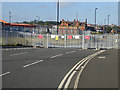
Road closed!
The road which runs north from Prince Consort Way to the waterfront at New Quay, North Shields is currently closed as massive redevelopment of the former dock area is under way.
Image: © Oliver Dixon
Taken: 30 Sep 2015
0.22 miles
7
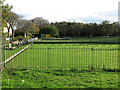
Bowling Greens, The Parks Sports Centre, North Shields
These bowling greens form part of the Parks Sports Centre which lies between Howdon Road and Minton Lane. This area was shown on the 1899 second edition of the Ordnance Survey Six-Inch map of the area as the, 'West End Recreation Ground', an area used for the recreation of the workers from the nearby Smiths Docks Company. For a selection of detailed free to download walking routes in the area visit www.northtynesidewalks.co.uk
Image: © Geoff Holland
Taken: 30 Oct 2020
0.24 miles
8

Interior of Metro carriage, looking towards the front
The best seat on the Metro is the one right at the front and next to the driver - this section (just arriving at Meadow Well station) is very straight
Image: © hayley green
Taken: 31 Aug 2009
0.24 miles
9
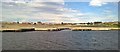
Once there were vibrant dockyards, now only peace
Image: © Chris Morgan
Taken: 12 Sep 2016
0.24 miles