
IMAGES TAKEN NEAR TO
Closefield Grove, WHITLEY BAY, NE25 8SU
Introduction
This page details the photographs taken nearby to Closefield Grove, NE25 8SU by members of the Geograph project.
The Geograph project started in 2005 with the aim of publishing, organising and preserving representative images for every square kilometre of Great Britain, Ireland and the Isle of Man.

There are currently over 7.5m images from over14,400 individuals and you can help contribute to the project by visiting https://www.geograph.org.uk
Image Map
Images are licensed for reuse under creativecommons.org/licenses/by-sa/2.0
Notes
- Clicking on the map will re-center to the selected point.
- The higher the marker number, the further away the image location is from the centre of the postcode.
Image Listing (29 Images Found)
Images are licensed for reuse under creativecommons.org/licenses/by-sa/2.0
Image
Details
Distance
1
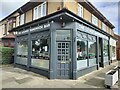
The Lounge Sandwich Bar & Cafe, Monkseaton
Situated on Cauldwell Lane, this bar/cafe sells a selection of sandwiches, paninis, jacket potatoes, soup, salad boxes, hot and cold drinks.
Image: © Geoff Holland
Taken: 22 Sep 2023
0.14 miles
2
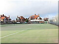
Beverley Park Lawn Tennis Club, Beverley Road, Monkseaton
Beverley Park Lawn Tennis Club was founded on 20th February 1920 and has four all weather courts and a clubhouse with a kitchen and changing facilities including toilets and a shower area. The club also has disabled access with a disabled toilet on site. The Club were named Tennis Club of the Year at the Northumberland Lawn Tennis Association Awards 2018. For a selection of detailed free to download walking routes in the area visit www.northtynesidewalks.co.uk
Image: © Geoff Holland
Taken: 18 Jan 2021
0.14 miles
3
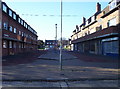
Flats and Shops
Blocks of housing and shops in Monkseaton - the majority of the shops are boarded up and the whole street looks a little sad and run-down.
Image: © Weston Beggard
Taken: 13 Nov 2005
0.16 miles
4
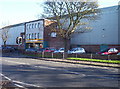
Ice Rink
Whitley Bay Ice Rink and ten-pin bowling centre. In the 80s and 90s, this place used to regularly host gigs as well, but this practice seems to have diminished greatly in recent years.
Image: © Weston Beggard
Taken: 13 Nov 2005
0.16 miles
5
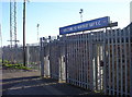
Whitley Bay FC
Hillheads Park - the home ground of Argrove Northern League stalwarts, Whitley Bay FC
Image: © Weston Beggard
Taken: 13 Nov 2005
0.16 miles
6
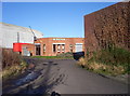
Residents Club
Whitley Bay Residents' Club, hidden away behind the ice rink.
Image: © Weston Beggard
Taken: 13 Nov 2005
0.16 miles
7
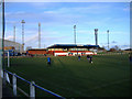
Warming up at Hillheads.
Footballers do some light training and practice before Whiley Bay's FA Vase match with Coalville (The match finished 1-0).
Image: © Roger Cornfoot
Taken: 16 Dec 2006
0.16 miles
8
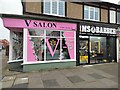
Parade of Retail Units, Cauldwell Lane/Crawford Place, Monkseaton
This small parade of retail units includes, as seen in this photograph, V Salon Hairdressers and MS Barbers.
Image: © Geoff Holland
Taken: 5 Nov 2024
0.16 miles
9
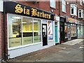
Parade of Retail Units, Cauldwell Lane, Monkseaton
This small parade of retail units includes, as seen in this photograph, Sia Barbers, Primrose Massage & Beauty and Monkseaton Nail Bar & Beauty.
Image: © Geoff Holland
Taken: 5 Nov 2024
0.16 miles
10
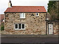
Garden Cottage, Bygate Road, Monkseaton
This stone building, which is clearly shown on the first Ordnance Survey Six-Inch map of the area published in 1865, was described in the 'Monkseaton Conservation Area Character Appraisal', published by North Tyneside Council in October 2006 as, "an important example of the more diminutive outhouses and cottages which must have characterised Bygate Road, Back Lane and The Fold before suburbanisation". During the 1840s it was said to have been known known as "Ramsay's Fort" because the owner, a certain Robert Ramsay, was supposed to have two imitation cannons on the roof, with the intention of frightening away the French should they ever invade". For a selection of detailed free to download walking routes in the area visit www.northtynesidewalks.co.uk
Image: © Geoff Holland
Taken: 18 Jan 2021
0.19 miles