
IMAGES TAKEN NEAR TO
Holywell Close, WHITLEY BAY, NE25 0LD
Introduction
This page details the photographs taken nearby to Holywell Close, NE25 0LD by members of the Geograph project.
The Geograph project started in 2005 with the aim of publishing, organising and preserving representative images for every square kilometre of Great Britain, Ireland and the Isle of Man.

There are currently over 7.5m images from over14,400 individuals and you can help contribute to the project by visiting https://www.geograph.org.uk
Image Map
Images are licensed for reuse under creativecommons.org/licenses/by-sa/2.0
Notes
- Clicking on the map will re-center to the selected point.
- The higher the marker number, the further away the image location is from the centre of the postcode.
Image Listing (64 Images Found)
Images are licensed for reuse under creativecommons.org/licenses/by-sa/2.0
Image
Details
Distance
2
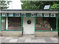
Bus Stop Shelter, Holywell Village
This attractive shelter has undergone a face lift since Peter Robinson was here in 2009 https://www.geograph.org.uk/photo/1531642 and is now decorated with a village theme. For a selection of detailed free to download walking routes in the area visit www.northtynesidewalks.co.uk
Image: © Geoff Holland
Taken: 17 Jun 2020
0.03 miles
3
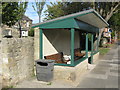
Bus stop shelter Holywell Village Northumberland
In Holywell Dene Road
Image: © Peter Robinson
Taken: 5 Oct 2009
0.05 miles
4
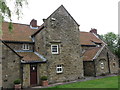
Holywell Manor House, Holywell
This Grade II Listed Building, which is also known as Strother Farm, was built in 1654 for Sir Ralph Bates, and was described by Nikolaus Pevsner in his 1957 book, 'The Buildings of England Northumberland' as the 'Old Hall'. The door lintel bears the inscription, 'Mediocria Firma' meaning, 'The Middle Course is Safe'. For a selection of detailed free to download walking routes in the area visit www.northtynesidewalks.co.uk
Image: © Geoff Holland
Taken: 17 Jun 2020
0.06 miles
5
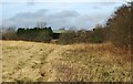
Pasture
Rough pasture landing looking towards Strother Farm also known as the Manor House, in Holywell Village
Image: © Christine Westerback
Taken: 9 Mar 2008
0.10 miles
6
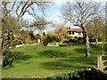
Holywell Village
Bungalow overlooking Holywell Dene
Image: © Christine Westerback
Taken: 9 Mar 2008
0.11 miles
7
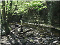
Rocky Outcrop and Retaining Wall, Holywell Dene
These features lie at a point where the Seaton Burn makes a sharp right hand turn in its course. The retaining wall appears to have seen better days although it still serves an important purpose. For a selection of detailed free to download walking routes in the area visit www.northtynesidewalks.co.uk
Image: © Geoff Holland
Taken: 15 Apr 2020
0.12 miles
8
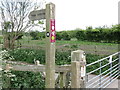
Sign, Public Bridleway, Holywell
This sign indicates the route of the 'Tyne & Wear Heritage Way' (black & white disc), an 80 mile route taking in the rich historic and industrial heritage of the area. The way is broken down into nine convenient sections that can be walked at any time, and in any order. It also indicates the 'Reivers Cycle Routes', a brace of waymarked bi-directional coast to coast cycle routes between the North and Irish Seas. There are two types of routes, an off-road route and an on-road route, with the off-road one being waymarked with dark red coloured waymarkers. This particular section is part of the off-road option indicated by the red and white sign on the post. For a selection of detailed free to download walking routes in the area visit www.northtynesidewalks.co.uk
Image: © Geoff Holland
Taken: 19 May 2020
0.12 miles
9
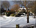
Bungalow - Holywell
Taken in the snows of 2010 but look at it in summer Image
Image: © Christine Westerback
Taken: 3 Jan 2010
0.12 miles
10
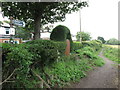
Public Footpath, Holywell
This is the start of this public footpath as it heads towards the course of the old Avenue Branch of the Blyth & Tyne Railway, passing along the way the Hollywell Pond Nature Reserve https://www.geograph.org.uk/photo/6513377. For a selection of detailed free to download walking routes in the area visit www.northtynesidewalks.co.uk
Image: © Geoff Holland
Taken: 19 Jun 2020
0.12 miles