
IMAGES TAKEN NEAR TO
Thornhill Close, WHITLEY BAY, NE25 0JS
Introduction
This page details the photographs taken nearby to Thornhill Close, NE25 0JS by members of the Geograph project.
The Geograph project started in 2005 with the aim of publishing, organising and preserving representative images for every square kilometre of Great Britain, Ireland and the Isle of Man.

There are currently over 7.5m images from over14,400 individuals and you can help contribute to the project by visiting https://www.geograph.org.uk
Image Map
Images are licensed for reuse under creativecommons.org/licenses/by-sa/2.0
Notes
- Clicking on the map will re-center to the selected point.
- The higher the marker number, the further away the image location is from the centre of the postcode.
Image Listing (7 Images Found)
Images are licensed for reuse under creativecommons.org/licenses/by-sa/2.0
Image
Details
Distance
1
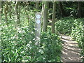
Permissive Bridleway, Holywell Dene
This permissive bridleway leaves the edge of the local housing estate and heads into Holywell Dene to join a number of other paths and tracks through this pleasant woodland area. For a selection of detailed free to download walking routes in the area visit www.northtynesidewalks.co.uk
Image: © Geoff Holland
Taken: 2 Jun 2020
0.15 miles
2
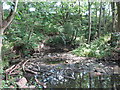
Sharp Bend in the Seaton Burn, Holywell Dene
At this point, the Seaton Burn turns from a generally north north east course to a generally south south east course, the sharpest turn in the full length of the burn. As a consequence, a considerable amount of water borne woody debris, such as logs, sticks and branches, has collected where the burn turns. For a selection of detailed free to download walking routes in the area visit www.northtynesidewalks.co.uk
Image: © Geoff Holland
Taken: 2 Jun 2020
0.16 miles
3
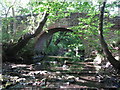
Bridge over the Seaton Burn, Holywell
This delightful narrow bridge is built mainly of stone supported by an arch of brick. When the first Ordnance Survey Six-Inch map of the area was published in 1865 there was no bridge at this point shown on the map. However, by the time the 1897 Ordnance Survey map was published this bridge was shown on the map. For a selection of detailed free to download walking routes in the area visit www.northtynesidewalks.co.uk
Image: © Geoff Holland
Taken: 2 Jun 2020
0.19 miles
4
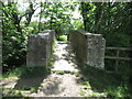
Public Footpath over Seaton Burn, Holywell
This public footpath crosses this narrow bridge, which can also be seen at https://www.geograph.org.uk/photo/6495006, and then heads towards Seghill. For a selection of detailed free to download walking routes in the area visit www.northtynesidewalks.co.uk
Image: © Geoff Holland
Taken: 2 Jun 2020
0.19 miles
5
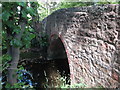
The Seaton Burn, Holywell Dene
At this point the Seaton Burn flows beneath a fine stone and brick built bridge which can also be seen at https://www.geograph.org.uk/photo/6495006 but from the opposite side. The bridge is only wide enough for pedestrian/cyclist access. For a selection of detailed free to download walking routes in the area visit www.northtynesidewalks.co.uk
Image: © Geoff Holland
Taken: 2 Jun 2020
0.19 miles
6
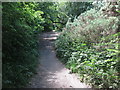
Footpath, Holywell Dene
This footpath, which is not shown as a public footpath but has been used as such for many years, follows the line of an old mineral railway which first appeared on the 1897 edition of the Ordnance Survey Six-Inch map of the area. It appears to have connected the northern site of East Holywell Colliery, close to Avenue Head (Seaton Delaval), with the southern site of the colliery to the north west of Earsdon. At this point, the footpath crosses the Seaton Burn via an embankment of considerable depth through which the Seaton Burn flows via a culvert. For a selection of detailed free to download walking routes in the area visit www.northtynesidewalks.co.uk
Image: © Geoff Holland
Taken: 2 Jun 2020
0.22 miles
7
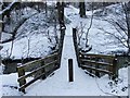
Bridge Crossing Seaton Burn - Holywell Dene
Taken in the snow of 2010; the bridge, which is now made of metal, was once timber. Vandals were forever burning it or taking the wooden slats that formed the bridge. Eventually, the local authority saw sense and replaced it with a more permanent structure. The vandals burn the trees now!
Image: © Christine Westerback
Taken: 3 Jan 2010
0.23 miles