Bridge over the Seaton Burn, Holywell
Introduction
The photograph on this page of Bridge over the Seaton Burn, Holywell by Geoff Holland as part of the Geograph project.
The Geograph project started in 2005 with the aim of publishing, organising and preserving representative images for every square kilometre of Great Britain, Ireland and the Isle of Man.

There are currently over 7.5m images from over 14,400 individuals and you can help contribute to the project by visiting https://www.geograph.org.uk
Bridge over the Seaton Burn, Holywell
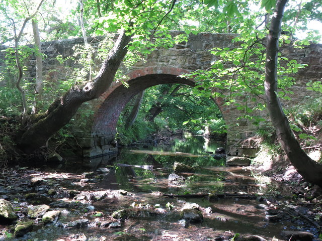
Image: © Geoff Holland Taken: 2 Jun 2020
This delightful narrow bridge is built mainly of stone supported by an arch of brick. When the first Ordnance Survey Six-Inch map of the area was published in 1865 there was no bridge at this point shown on the map. However, by the time the 1897 Ordnance Survey map was published this bridge was shown on the map. For a selection of detailed free to download walking routes in the area visit www.northtynesidewalks.co.uk
Images are licensed for reuse under creativecommons.org/licenses/by-sa/2.0
Image Location


Leaflet Map data © OpenStreetMap
Latitude
55.063605
Longitude
-1.526657