
IMAGES TAKEN NEAR TO
Linden Road, WHITLEY BAY, NE25 0DB
Introduction
This page details the photographs taken nearby to Linden Road, NE25 0DB by members of the Geograph project.
The Geograph project started in 2005 with the aim of publishing, organising and preserving representative images for every square kilometre of Great Britain, Ireland and the Isle of Man.

There are currently over 7.5m images from over14,400 individuals and you can help contribute to the project by visiting https://www.geograph.org.uk
Image Map
Images are licensed for reuse under creativecommons.org/licenses/by-sa/2.0
Notes
- Clicking on the map will re-center to the selected point.
- The higher the marker number, the further away the image location is from the centre of the postcode.
Image Listing (11 Images Found)
Images are licensed for reuse under creativecommons.org/licenses/by-sa/2.0
Image
Details
Distance
1
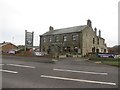
The Hastings Arms pub, Seaton Delaval
A pub located in the Wheatridge area of Seaton Delaval.
Image: © Graham Robson
Taken: 10 Dec 2016
0.17 miles
2
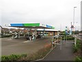
Filling station, Blackhaugh Drive, Seaton Delaval
A modern filling station sporting Harvest branding located on the western edge of Seaton Delaval.
Image: © Graham Robson
Taken: 10 Dec 2016
0.19 miles
3
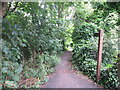
Public Footpath, Seaton Delaval
This is the opposite end (north eastern) of the public footpath shown at https://www.geograph.org.uk/photo/6529456 and lies next to the A192 road. The wooden signpost point the way towards Holy Trinity Church and Mare Close Farm, Seghill. For a selection of detailed free to download walking routes in the area visit www.northtynesidewalks.co.uk
Image: © Geoff Holland
Taken: 7 Jul 2020
0.20 miles
4

Mineral railway passing Seaton Dealaval
Looking north along the single track mineral railway line serving Blyth docks and Lynemouth Power Station. A pair of pipes cross above the track in the foreground.
Image: © Graham Robson
Taken: 10 Dec 2016
0.20 miles
5
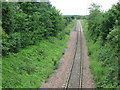
Mineral Railway Line, Seaton Delaval
This mineral railway links Blyth and Lynemouth with the East Coast Main Line and was once part of the former Blyth & Tyne railway network. It is also shown at https://www.geograph.org.uk/photo/6524298, further up the line towards Seghill. For a selection of detailed free to download walking routes in the area visit www.northtynesidewalks.co.uk
Image: © Geoff Holland
Taken: 7 Jul 2020
0.21 miles
6
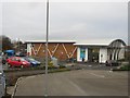
Coop supermarket, Blackhaugh Drive, Seaton Delaval
A modern supermarket, part of the Lakes and Dales branded Cooperative Society in the Wheatridge Park area of Seaton Delaval.
Image: © Graham Robson
Taken: 10 Dec 2016
0.21 miles
7
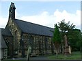
Parish Church of the Holy Trinity
Mares Close, Seghill
Image: © Christine Westerback
Taken: 10 Aug 2005
0.21 miles
8

The Duchess visits Seaton Delaval
The Duchess of Sutherland prepares to pass under the road to Morpeth from Seaton Delaval on the A192.
Image: © Richard Armstrong
Taken: 1 Oct 2005
0.21 miles
9
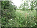
Public Footpath Near Holy Trinity Church, Seghill
This is the public footpath which lies immediately beyond the gate shown at https://www.geograph.org.uk/photo/6529467. It leads to and behind the area of Seaton Delaval known as Wheatridge. For a selection of detailed free to download walking routes in the area visit www.northtynesidewalks.co.uk
Image: © Geoff Holland
Taken: 7 Jul 2020
0.22 miles
10
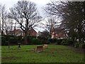
Memorial park, Seaton Delaval
Poppies in a park between Double Row and A192.
Image: © Richard Webb
Taken: 26 Jan 2019
0.23 miles